
Until late in the 19th century the Parish was referred to as St. Anne; the spelling of the name as Santon is supposedly after the railway station was so named by the sign painter in the 1870's (though this is probably a myth as the name Santon also appears in earlier documents).
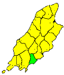
THE parish of Santon (St. Ann) lies between Port Soderick and the Santon Burn, and extends inland for about 3½ miles. The area is about seven to eight square miles. The coastline is high and dangerous contains several small inlets, of which Port Greenaugh, Port Soderick) and the mouth of the Santon Burn, are the largest. The principal headland is St. Ann's Head. The surface consists of several low, hilly fields, sloping to the coast, with intervening depressions, the principal of which are Glen Greenaugh and Santon Burn Glen. The soil in general is poor, and agriculture backward. The population is entirely agricultural, and is sparsely scattered over the district.
Brown's Isle of Man Directory, 1894
|
|
||
|
© F.Coakley, 2006 |
||