
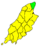
THE parish of BRIDE (or St. Bridget) extends from the Point of Ayre on the north, to Lezayre on the south; and from Andreas eastward to the sea. It includes an area of about nine square miles Physically it is a continuation of the district of Andreas, being the eastern portion of the low, flat, district, which forms the northern extremity of the Island. The coast-line throughout is composed of drift gravels, sands, and clays, generally of no great elevation, but on some points, as at Point Cranstal and at Jurby Point, it rises to the height of of about 200 feet, and at these points some fine sections of the drift, or superficial deposits, may be found. This coast-line is singularly unbroken, not an inlet breaking its outline from Ramsey to the Lhen Mooar, a distance of about 12 miles. Several extensive sandbanks have been formed along this coast from the waste of its materials, which, from their position in the tract; of vessels navigating the North Channell, are very dangerous to shipping. Among these are the Point of Ayre Bank, the Whitestone Bank, the Bahama Bank, and King William's Bank, which stretch along the coast from the Point of Ayre southwards. The extreme north of the district of Bride is a barren sandy waste; but further from the shore the soil becomes more fertile. A range of rounded sandhills crosses the parish from Point Cranstal, from which, notwithstanding their low elevation, a fine view is obtained of the low district of The Curragh with the towering mountains, and deep wooded glens of the northern portion of the great insular range, whilst, towards the east, the Scottish and Cumbrian mountains are distinctly visible. The Galloway coast distant about 18 miles, is especially distinct, looking almost like the farther bank of a wide estuary. On the Point of Ayre is a lighthouse about 100feet above the sea-level. In the old map of the Island, before referred to, Point Cranstal is called " Shellack Poynt," and a small village named 'Cranston' is marked close to it, but it has long disappeared.
Brown's Isle of Man Directory, 1894
|
|
||
|
© F.Coakley, 2006 |
||