
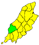
NORTH of Rushen to the river Neb, is the parish of Patrick, a wild mountainous region, including the northern slopes of Barrule and Slieauwhallin, and, to the west, the Dalby Mountains, with the Peel hills to the north. Between Mount Dalby and Barrule is Glen Rushen, a deep highland glen, called in its lower part Glemnaye. Through this glen flows the Glenmaye river, which forms the beautiful Glemnaye waterfall, about owe mile from the sea. The district is barren, and only a small part of its area is capable of cultivation. The district north of Barrule is metalliferous, and several of the veins of lead are worked in Glen Rushen, and its offshoot Glen Dhoo. In Glen Rushen also are extensive slate quarries, which at one time promised to tee very successful. The population is partly agricultural, fishing, and mining, and is sparsely distributed over the parish. Glenmaye is the principal village, it is much frequented by tourists on account of its beautiful scenery and waterfall. Dalby village is a small collection of houses, near the coast on the west side of Dalby mountain.
Brown's Isle of Man Directory, 1894
|
|
||
|
© F.Coakley, 2006 |
||