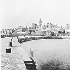
The New Basin + pier c.1900
|
The New Basin + pier c.1900 |
 |
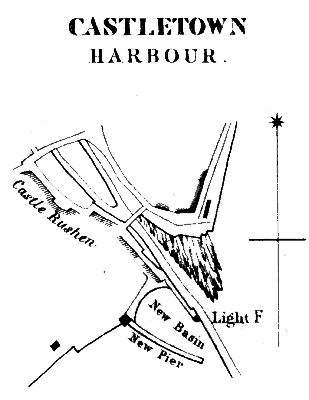
An early view of Castletown harbour may be seen in Daniel King's views of 1643 - this would appear to be drawn from near Castle Rushen looking towards where now stands the foot bridge (most seaward bridge on plan). |
The New Basin (or dry harbour) was constructed in 1844-5 at a sum of £2,700 and was criticised by Commander Washington in his 1845 report as un-necessary and not recommended by the engineers, Mr. Walker or Sir John Rennie, nor sanctioned by the Treasury or the Admiralty.
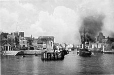
S.S. Tyrconnell entering Castletown harbour (prob c. 1912)
The original bridge across the Silverburn was the most seaward of the two shown on the plan - the road from Douglas came along the shore line and crossed the river over a high arched bridge across the narrow gap. Early in the 19th Century the larger bridge that now separates the inner harbour from the 'duckpond' beyond was built and a quay built along the side of Castle Rushen. The West (or Irish) Quay was also constructed upon which stood several buildings including the Umber House.
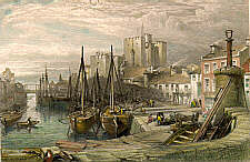
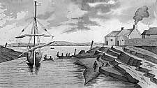
Castletown Harbour c 1840
|
|
||
|
|
||
|
|
||
| Any comments, errors or omissions gratefully received The
Editor © F.Coakley , 2008 |
||