|
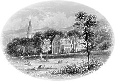
Laxey Glen
|
Probably c.1860 - the Lady
Isabella Waterwheel soon became a tourist attraction.
Laxey
Church, built with money from the Mining Company, stands
on probably the only flat bit of ground in Laxey.
|
|
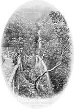
Laxey Wheel
- the Lady Isabella - started in operation in September
1854.
|
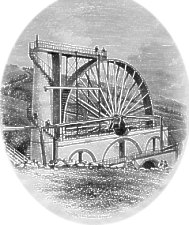
Laxey Wheel
|
|
Lezayre Church and Vicarage
|
Lezayre
Church was rebuilt by Bishop Ward
|
|
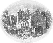
The Bishop
Ward Church to a design by John Welch is well drawn
though some artistic licence has been taken with the placing
of Bishop Wilson's Tomb which is in the shadow of part of
the chancel wall of the old church.
|
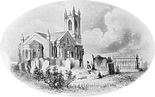
Kirk Michael Church with Bishop Wilson's Tomb
|
|
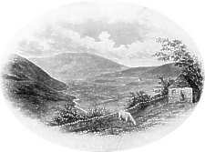
Snaefell
|
Snaefell,
the highest mountain on the Island, now 'crowned' by two
radio masts was for long a place of summer pilgramage before
coming a tourist attraction especially following the opening
of the Mountain Railway.
The view is from the North looking South East along the
Sulby from near Tholt-y-Will.
|
|
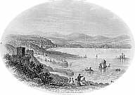
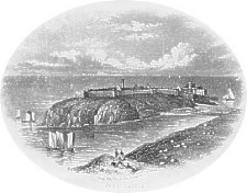
Castletown viewed from Scarlett - the cave-like structure
is proably part of the lime kilns.
|
Castletown
|
|
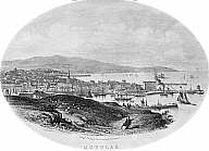
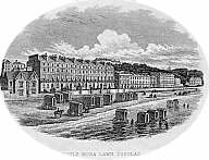
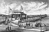
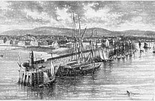
Castletown from the Pier
|
This is the 1844/5 basin and harbour riticised by
Captain
Washington in his 1851 report as unnecessary.
The pier at the entrance to the harbour is now extended
and boasts a small harbour
light - possibly the artist omitted this as a mid 1850s
print (from a photograph) shows a box-like structure which
was presumably soon replaced by the tower light seen
today.
|
|
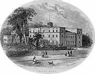
Castle
Rushen viewed from across the harbour (in front of what
was then the Brewery).
|
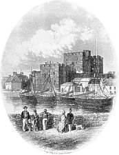
Castle Rushen
|
|
Glen May
|
Glen Maye,
about 3 miles south of Peel, is still a popular tourist
haunt.
|
|
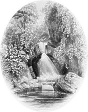
Dhoon
Glen
|
Dhoon Glen and Waterfall
|
|
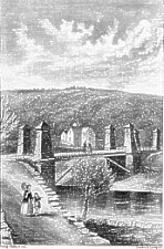
Swiss Cottage and Suspension Bridge
|
Glen Helen
became a major tourist attraction from the 1860s.
|
|
Port Erin was still to grow - this view probably dating
from the early 1870s.
The building to the right is the rebuilt Dandy
Hill Methodist Chapel of 1860.
|

Port Erin
|
|
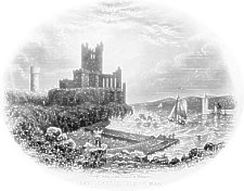
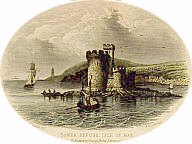
Peel Castle
|
My copy is on a China card - the collected views use a
different and less 'romantic' view of the Castle.
The causeway to the castle, now replaced by a more modern
roadway is the wall
built c.1796 to protect the harbour
|
|
The classic view of St
Patrick's Isle and the Castle seen from the slopes of
Peel (Horse) Hill.
|
Peel Castle
|
|
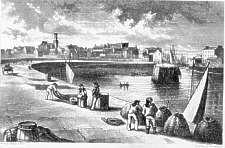
Peel Town and Harbour
|
Note the new 'pepperpot' harbour light
- a large improvement on the box like light that is shown in
the similar view by
Backwell.
|
|
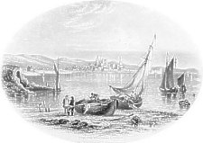
|
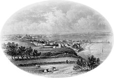
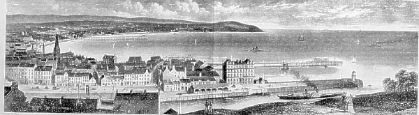
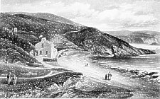
Ramsey from the South
|