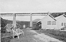
Looking up the glen
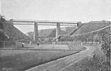
Looking down towards the beach - the path led down from Kirk Michael station.
|
|
Looking down towards the beach - the path led down from Kirk Michael station. |
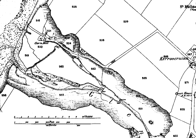
Mill Dale - the lower section was once known as known as Bordall or Borodal and was the presumed site of Bordal Mill. The 1868 O/S map (pre Railway and viaduct) shows the corn mill at the end, as well as the large flat area ideal for tennis courts etc.
It was a very popular destination for Sunday School outings - helped no doubt by its Methodist developer who did not serve alcohol.
The corn mill at the end of the glen, shown below in the detail from a sketch, possibly by JosephColeman, in the late 19th Century, was washed away in the 1950's
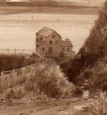
Glen Wyllin Mill c. 1890
|
|
||
|
|
||
|
Any comments, errors or omissions
gratefully received The
Editor |
||