
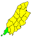
THE parish of Rushen is one of the most interesting of the Manx Ecclesiastical divisions. It includes the south-western extremity of the Island, together with the Islet of the Calf, and contains an area of about 10 square miles. It stretches round the coast from Strandhall to the tremendous precipices west of Cronk-ny-Irey Lhaa, known as the Stocks, or the Slogh, a distance of 16 miles: and it includes some of the grandest scenery to be found along the entire Manx coast. The principal headlands are Port St. Mary Point, Black Head, Spanish Head (350 feet), and Bradda Head (766 feet); and the chief openings are Port St. Mary Bay, Perwick, Stack a-Bay, Port Erin Bay, and Fleshwick. In physical conformation it consists of a hilly region stretching from Cronk-na-Irey Lhaa (1,449 feet), along the western coast through Slieau Whallian, the Bradda Hills, and the Mull Hills to the Sound, across which again the ridge is continued through the Calf Along their western face these hills are precipitously abrupt, sinking down into the sea in huge mountainous cliffs, scarcely paralleled m any part of the British Islands for height and rugged grandeur, but towards the south-east they descend more gradually into the plain of Castletown, except in the Mull district, west of St. Mary, where the coast is as rugged as along the west. The uplands are barren, and in great part unenclosed, but the lower slopes of the hills are in pasture, and in a few places, under cultivation. The lowlands along the foot of the hills are generally fertile and well cultivated. The occupations of the inhabitants are various. The greater part are fishermen, cultivating small patches of land when not at sea, others are miners, working the Bradda, the Ballacorkish, and other mines, when they are open; and others, again, at Port Erin, and Port St. Mary, depend mainly upon the summer visitors. The population is thickly spread over the entire district, except the remoter parts of the rugged western hills and the principal centres of population are Port St. Mary, an important fishing village, and the headquarters of the southern division of the Manx fishing fleet; Port Erin, a rising watering-place, situated on the beautiful bay of that name, and the southern terminus of the railway; and Colby, a small mining and agricultural village.
Brown's Isle of Man Directory, 1894
|
|
||
|
© F.Coakley, 2006 |
||