
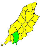
THE parish of Malew(from St. Lupus, the patron Saint of the district) is bounded on the east by the Santon Burn, on the north by the Granite Mountain, and South Barrule on the south, by an irregular line from Barrule to Pooil Vash on the west, and by the sea on the east. It contains about 15 square rniles. The southern half of this extensive parish has for its sub-rock a thick series of carboniferous limestones, and is low and undulating, forming part of the southern plain of Castletown. The northern half is high, the hills which form it rising out of the low plain and swelling into the mountains of the southern range. The chief river is the Silverburn, the western branch of which rises on Barrule, and the eastern branch on the Granite Mountain. The two streams unite above Ballasalla, and flow in a S.E. direction into the sea at Castletown. The coast line is low, but rocky and dangerous. It contains two great openings-Derbyhaven, a fine natural harbour, protected by a small breakwater; and Castletown Bay, a deep but exposed and dangerous inlet between Langness and Scarlett. The headlands are Dreswick Point and Langness Point, the two extremities of the long, low peninsula of Langness; and Scarlett Point, a conical mass of sub-columnar basalt. The north part of the district, along the slopes of the mountains, is barren and in great part unenclosed; lower, the land is of greater value, and is carefully cultivated. The level district around Castletown is among the richest and best worked parts of the Island. The district is chiefly agricultural, but a considerable number of its inhabitants follow other employments. At Derbyhaven and Castletown they are fishermen, at Scarlett and at Ballasalla they are employed at the extensive lime quames and kilns. At Ballasalla also are very large fruit gardens, employing in the summer a large number of women and children. Castletown is in this district. Ballasalla is a large agricultural village. Near it are the ruins of Rushen Abbey, founded in 1098, and dissolved late in the reign of Elizabeth, and an ancient bridge over the Silverburn, called the Crossag, or the Monk's Bridge, too narrow for vehicles. Derbyhaven is an agricultural and fishing village. St. Mark's, in the northern division of the pansh, is a small agricultural village clustered round a chapel of ease. Near it was a huge granite boulder, and an old Danish fort immortalised by Scott in 'Peveril of the Peak '
Brown's Isle of Man Directory, 1894
|
|
||
|
© F.Coakley, 2006 |
||