
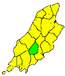
MAROWN, the Midland Parish of Man, is the only one which does not touch the sea. It includes the middle section of the central valley from Greeba to Union Mills, with the mountainous regions on either side from Colden and the village of Baldwin to the Santon Burn. It contains about nine square miles. Its only river is the Dhoo, which flows into the valley, and into which several smaller streams fall. It is an agricultural district, but its soil is only moderately fertile. A great part of the valley is boggy, and subject to heavy floods.
Brown's Isle of Man Directory, 1894
|
|
||
|
© F.Coakley, 2006 |
||