
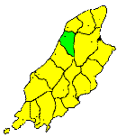
THE parish of Ballaugh is less hilly than that of Michael, which it adjoins towards the south. It stretches for three miles along the coast to the mouth of the Carlane river, and its average breadth is about 2½ miles. Its area is about 10 square miles. The southern part of the district is mountainous, lying along the slopes of Slieau Dhoo and Montpellier, but its northern part is low, and forms part of the great northern depression of The Curragh. From this circumstance its name, Ballaugh (Balla Lough), is derived. In the map engraved for Speed's History of Great Britain, in 1595, this lake is marked with its outlet at Ballamona-mooar; and, though it has long been drained, small sheets of water still remain in different parts, as the Dollagh Moar, between the old and the new churches, the Dollagh Beg, near the new church, and others; and traces of it also remain in the names of numerous places in the district, as Cashtal Lough (the castle in the lake), Lough Dhoo,&c. The principal stream of the district is the Ravensdale river, which rises on Slieau Dhoo and flows through Glen Dhoo and Ravensdale, past the village of Ballaugh, and empties itself into the sea by the ancient outlet of the lake. It is an agricultural district, and contains a scattered population. Its only village is Ballaugh, prettily situated at the mouth of the Ravensdale valley.
|
|
||
|
© F.Coakley, 2006 |
||