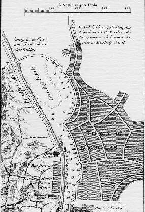
The first plan of Douglas Harbour is that of Peter Fannin, inset in his map of the Island of 1789.
The inner harbour shows the graving bank (tongue) and the harbour bounded by North Quay.
The outer harbour shows the position of the quay and and lighthouse washed away in Nov 1786 - shown on Pollock rock was the old fort..
An interesting description of the ruinous state of the harbour following the storm of 1786 can be found in the report of 1792 and also in chapter 2of David Robertson's Tour of 1794.
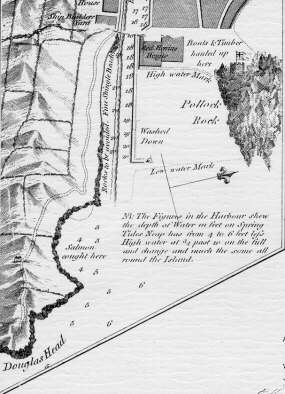
The Red Pier was constructed in 1793 to replace the storm damaged earlier pier which produced the 'double corner' at the entrance to the inner harbour. At the instigation of Sir Wm Hillary the Tower of Refuge was built on the dangerous Connister Rocks
WILLIAM WORDSWORTH. - ON ENTERING DOUGLAS BAY.
THE feudal Keep, the bastions of Cohorn,
Even when they rose to check or to repel
Tides of aggressive war, oft served as well
Greedy ambition, armed to treat with scorn
Just limits: but yon Tower whose smiles adorn
This perilous bay, stands clear of all offence:
Blest work it is of love and innocence,
A Tower of Refuge built for the else forlorn.
Spare it, ye waves, and lift the mariner,
Struggling for life, into its saving arms!
Spare, too, the human helpers! Do they stir
'Mid your fierce shock like men afraid to die ?
No; their dread service nerves the heart it warms,
And they are led by noble HILLARY !
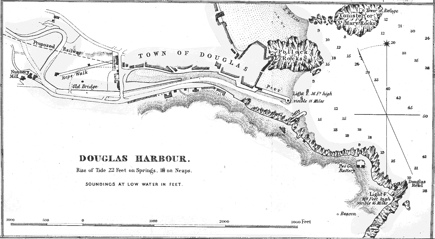
The 1846 plan shows the North and South Quays and the small jetty built near Fort Anne - the pier is the Red Pier of 1796 with its light - the proposed railway had to wait until 1873. The old bridge (traces of whose abutments were only removed c. 1999 when considerable harbour work was done to install a water retention scheme) which probably resembled the Ballasalla Crossag bridge, led by a path across the 'lake' from the Castletown Road to the heart of old Douglas which lay towards the western end of the inner habour. Captain John Washington was quite critical of the enclosure of the 'lake' in 1820 by the then owner of the Nunnery (as he is also of the other encroachments and enclosures around the harbour).
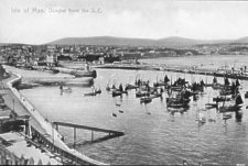
Douglas Harbour from S.E. c.1897
The view shows the outer harbour viewed from above Battery pier, later extended to give a protective breakwater - the lifeboat house and launching ramp are shown as is the travelling crane in the Habour Commissioners' yard. Part of the Herring fishing fleet can be seen
...TBA
A small fleet of steam ferries plied the harbour for the first half of the 20th century.
Kinley, W.B.,The Development of Douglas Harbour: A Mariner's
View Proc IoMNHAS X No 2 pp65/85 1993
Kniveton G.N. et al Douglas Centenary 1896-1996 Douglas: The
Manx Experience 1996
|
|
||
|
|
||
|
Any comments, errors or omissions
gratefully received The
Editor |
||