 John Emslie, 1848John Emslie, 1848
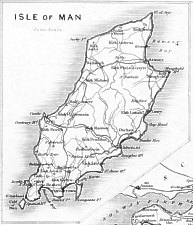
125 x 180 mm
Poorly prepared atlas 32 clearly engraved plates ; IoM inset in pentagonal frame top lh corner of 7: [North Cumberland]
John Emslie (1813-1875) draughtsman & engraver. The map had a long history being adopted for use in one of the first geological atlases, the incorrect square-shouldered IoM map was not altered to reflect the more accurate 1867 O/S until post 1904 !
Chubb DXXVI; Smith XLIX
State i: (Ae(os): "Drawn & Engraved by John Emslie" ; Ce(os): imprint "Published by J Reynolds 174 Strand."; Ee(os): “7” )
Reynolds's Travelling Atlas of England: with all the Railways and Stations accurately laid down. Constructed from the Surveys of the Board of Ordnance, Railway Companies and other Authorities
London : Simpkin, Marshall & Co Sationer's Court; and James Reynolds 174 Strand 1848
State ii: Geologically coloured (hand) impressions of those issued in Reynolds Travelling Atlas 1848
Reynolds's Geological Atlas of Great Britain, comprising a series of Maps in which the Roads, Railways and geological features of England and Wales are accurately laid down: with a Geological Map of Scotland
London Published by James Reynolds 174 Strand 1860
State iii: removal of outer border to sheet ; plate no 7 moved within border - otherwise as earlier
Reynolds's Geological Atlas of Great Britain, comprising a series of Maps in which the Roads, Railways and geological features of England and Wales are accurately laid down: with a Geological Map of Scotland
London Published by James Reynolds 174 Strand 1864
State iv: change in geological info in N Cumberland (section no 16 E of Carlisle altered with extn of 18 upto Kirkbride
Reynolds's Geological Atlas of Great Britain, comprising a series of Maps in which the Roads, Railways and geological features of England and Wales are accurately laid down: with a Geological Map of Scotland
London Published by James Reynolds 174 Strand after 1864
State v: {text rfrs to 1878 data} IoM still sq shouldered - no railways on IoM - Solway viaduct shown on N.Cumberland
Reynolds's Geological Atlas of Great Britain, comprising a series of Maps in which the Roads, Railways and geological features of England and Wales are accurately laid down: with a Geological Map of Scotland
London Published by James Reynolds 174 Strand 1880
State vi: Imprint London:Published by James Reynolds & Sons, 174, Strand (Ce ob) + changes in (6)
Reynolds's Geological Atlas of Great Britain, comprising a series of Maps in which the Roads, Railways and geological features of England and Wales are accurately laid down: with a Geological Map of Scotland
London:Published by James Reynolds & Sons, 174, Strand
State vii: 1899+ Imprint London Edward Stanford 12,13 & 14 Long Acre WC; scale bar added (prev 'same scale')new geological info from OS;Index to OS sheets Ae; colours added by litho (sq edged); Rlys D-Peel;D-South;St Johns-Ramsey + Foxdale;double border + plate no moved between inner&outer borders
The IoM map was then redrawn to follow the O/S plates were reissued in Stanford's Geological Atlas of GB by H.B.Woodward 1904 (litho coloured )+ used upto 1932?
State viii: updated plates redrawn from O/S (+ litho coloured) were issued in
Stanford's Geological Atlas of GB by H.B.Woodward 1904 onwards
1st ed 1904 used old Emslie plate (+Solway viaduct shown)
2nd ed 1907 used redrawn plate (but did not show MER)
3rd ed 1913 plate number moved
State ix: 1913 D-Lax+Ramsey Elec Rly added+ Snaefel railway
4th ed post 1923 showed MER + Snaefel Mountain Rly
|
|
||
|
|
||
|
|
||
|
Any comments, errors or omissions gratefully received
The Editor © F.Coakley , 2004 |
||