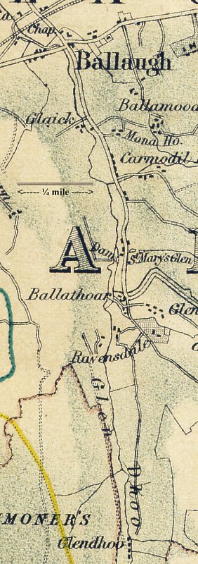
The map taken from a large scale Philips map of early 1870's based on the O/S map of 1869 with the addition of the proposed Manx Northern Railway (no stations are shown).
Ballaugh Village is at the top left centre - the road to Ravensdale turns south immediately after the bridge by the side of the Raven Hotel (this is a new name - in 1860's was the North Inn).
The old name for the area was the Knockan which led onto Glen Dhoo ('dark glen') and Glen Shoggall (running off to south-east from Ballathoar.
Diverging from the main road at the east end of the bridge, and continuing along a wide lane thinly scattered with houses, the visitor finds himself in the noble glen of Ravensdale. Less pleasing in its general character than many others of the Manx glens, Ravensdale is nevertheless striking for its gloomy grandeur, its bold and sterile heights rendering it a fitting haunt for the weird and powerful creatures which supply its name. Druidale, an enchanting vale in the parish of Michael, is reached by the road that runs through Ravensdale.
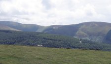
Looking towards Ballaugh Plantation
The Hills are now wooded - Ballaugh Plantation starts immediadely above Ravensdale House - but during the 19th Century and earlier would be moorland used as Common Land for keeping sheep during the summer.
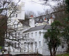 Ravensdale House |
 |
The original house on the site of Ravensdale was built by Capt Wm Kelly when he retired to the Island in 1817; - after his death in 1823 was occupied by Rev Wm Gill, intending to take boarders for his school - however he soon moved to Malew where he became vicar in 1830. For part of the late 20th Century operated as the Ravensdale Castle hotel before reverting back to private ownership.