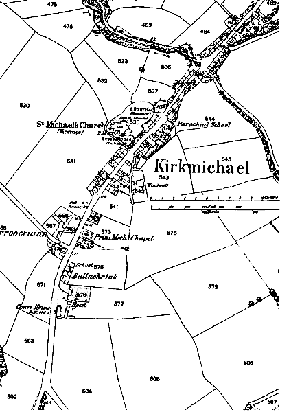
Village from O/S 1868 Map
Village from O/S 1868 Map
The ribbon development of the village along the road from Peel/St Johns to Ballaugh and Ramsey can be seen - the map predates the arrival of the Manx Northern Railway whose tracks ran some 200m north and parallel to the road
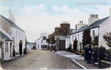 |
Looking North this Postcard view, c 1909, shows the entrance to the old school in the centre of the village . | |
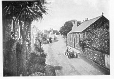
| The other view, dating from c.1908 (the car is presumeably in one of the early TT races) shows the view looking south taken from the old school - the church hall built on the edge of the old Church yard is visible |
 |
|
At the south of the village is the Mitre Hotel adjacent to the small courthouse and cell.
|
|
||
|
|
||
|
|
||
|
Any comments, errors or omissions gratefully received
The Editor |
||