
[From Train's History, 1845]
Sheading of Rushen — The Castle — Ruins of Bushel's House — The Split Rocks of Spanish Head — Villages on the Coast — Castletown — House in which the Keys meet — Law Courts and Prison — Sheading of Ayre — Ossified Man — View from the summit of Snafield — Sheading of Michael — Fossil Elk — Ballaugh — Bishop's Court — Sheading of Garff — Villages — Ramsey — Sheading of Glenfaba — The Sacred Mound — Peel — The Fishing Fleet — Middle Sheading — Country Seats — Kirk Braddan Church and Churchyard — View from Douglas Bay — The Lighthouse — Tower of Refuge — The Pier — Pollock Rock — Douglas — Parochial Distribution — Modern Institutions — Cholera Doctors — Life-boat Association — Churches — Courts and Post Office Department - Miscellany.
THE formation of the six small judicial departments called sheadings 1, into which the Island is divided, is ascribed by the Islanders. to their great legislator Mannanan-Beg-Mac-y-Lierr.2
SHEADING OF RUSHIN. — This sheading includes the ecclesiastical divisions of Arbory, Malew, and Kirk Christ Rushen.3 By the government census of 1841, the populationlation was ascertained to be 10,137. Part of this district is fertile and well cultivated, but the greater proportion of it is mountainous and barren. The hills of Brada, Mule, and Slieunycranane rise in great majesty in this part of the Island; whilst the western aspect of South Barrule rises to the height of one thousand five hundred and forty-five feet above the level of the sea.
The Calf islet is about five hundred yards distant from the southern promontory, in ancient times called the Mull.4 It is separated by a rocky channel or sound, called the Race, through which the sea often runs with such fearful rapidity, as to sweep vessels coming within its current, to almost certain destruction, either on jutting crags or on the formidable rock of Kitterland, which lies between the Calf and the mainland.5
Several high columnar rocks surround the Calf, which, in the course of ages, have evidently been detached from it by the impetuous dashing of the sea. On the western side, two natural pillars, of a triangular shape, named the Stacks,6 rise to a great height above the ocean; while on the southern point is a towering rock called the Eye, from an arch singularly perforated through it near the top. Besides the Eye, there is another rock of still more peculiar appearance, called the Burrough, near the summit of which is an excavation in the rock in the form of a cross, each of the two longitudinal cavities being six feet long, three wide, and two deep.
Though the Calf was once fortified,7 the only remains of any building of antiquity now to be observed in the islet, is the ruins called "Bushel’s house," situated on the highest part, and within a few yards of a rugged cliff overhanging the sea. The entrance to it is narrow, and the place appears to have had only one small room and a closet, scarcely sufficient to hold a bed. This was the residence of a recluse, whose motives for taking up his residence there, is thus described by himself in a petition to parliament, containing a mineral overture after his return to England :—" The embrions of my mines proving abortive by the sudden fall and death of my late friend, the chancellor Bacon, in king James’s reign, were the motives which persuaded my pensive retirement to a three year’s unsociable solitude, in the desolate island called the Calf of Man, where, in obedience to my dead lord’s philosophical advice, I resolved to make a perfect experiment upon myself, for the obtaining a long and healthy life (most necessary, for such a repentance as my former debauchedness required,) as by a parsimonious diet of herbs, oil, mustard, and honey, with water sufficient, most like to that of our long-lived forefathers before the flood, (as was conceived by that) which I most strictly observed, as if obliged by a religious vow, till divine providence called me to more active life."8
According to tradition, this spot was also the haunt of a person, who by his splendour and affluence, had been distinguished in the court of queen Elizabeth; but having, through an ill-founded jealousy, murdered a most beautiful woman, he sought shelter here from the vengeance of her friends and the punishment of the law, and amidst the caves and recesses of this lonely isle, lingered out a miserable existence of contrition and remorse.9
The islet is now the property of Mrs. Drinkwater, whose husband purchased it from the crown for the sum of three thousand pounds sterling, It is tithe free, and is at present let to a person who chiefly depends on the sale of feathers and rabbits, as the means of paying his rent. The rabbits are generally taken by rat-traps, placed close to the burrows, although occasionally by a long net, suspended between the burrows and pasture ground, supported perpendicularly by poles. When the nets are thus prepared, men go round and frighten the rabbits by driving them in the direction of the net, in which they soon become irrecoverably entangled, and are consequently taken. Upwards of two thousand rabbits are thus entrapped annually, between the months of October and April.
After the memorable tempest of the sixth and seventh January, 1839, had subsided, thousands of the sea birds that inhabited the Calf were found dead on the beach, chiefly about Spanish head. Among these the alca torda or razor-bill were very numerous, and not a few of the species called thalassidroma polagica or stormy petrel, known to seafaring people by the name of mother Cary’s chickens, the smallest of the web-footed ocean birds.
In the year 1588, some ships of the Spanish Armada were dashed in pieces on the southern promontory of Sparolett, which, from that circumstance, has been since called Spanish head [fpc: no record of any such ships can be found — the armada is known to have sailed up the west coat of Ireland]. From this bold headland, the table rock which rises about three hundred feet above the level of the sea, is, for a considerable way inland, divided into masses of a conical form, by fissures several feet wide respectively, which lead to subterraneous caverns, resembling, it is said, in miniature, the Eldenhole of Derbyshire.10 These remarkable chasms, twelve in number, do not run according to the veins in the stone, but across them. An earthquake is recorded to have taken place in Man, in an early age of the christian era, which was most probably the cause of this singular phenomenon. The following is an account of another earthquake felt also in the Island :—
"Douglas, Isle of Man, March 18, 1843."A slight shock of an earthquake was felt in this town and its vicinity yesterday morning, about one o’clock, a.m. The shock lasted a few seconds, and, in some cases, produced considerable alarm to the inhabitants, who were awoke by the oscillation felt in their houses. The shock was preceded by a rumbling noise, and followed by a sensible vibration from east to west. At the time of the shock the wind became instantly calm, but a considerable motion was observed in the sea after it had subsided, and the waves dashed violently against the adjacent shore. Aftei the lapse of a few minutes, the wind again rose to a stiff breeze. From all we can hear, the earthquake appears to have been felt throughout the Island, and particularly at Castletown, where the inhabitants of the College were fearfully alarmed by the shaking of the buildings. We are happy to say that no worse results happened than alarm to the timid, and general surprise to those who were disturbed in their midnight slumbers by its occurrence.
"To Mr. Court, of the Underwriters’-room, Liverpool."
Experiments were made many years ago at Ronaldsway, to ascertain if coal existed there, but the only coal substance discovered, was that termed by geologists anthracite, or blind coal, and that even in such small quantities as not to repay the expense of working it. Subsequently a number of spirited gentlemen obtained a lease from the crown, of all coal that can be found in on paying a royalty of one-seventh part of the gross produce, of such mines as may be worked.11 The lessees of the crown, in October, 1837, published a prospectus for the formation of an "Isle of Man coal company," to consist of one thousand shares, at three pounds.per share. It was announced in the periodicals of the day, that "a valuable mine of fine sea coal has been discovered at a place called Glen Crossack, in the Isle of Man, which is being worked by the Isle of Man coal company, with every prospect of a rich harvest. 12 But some are of opinion that there is yet as little chance of finding any considerable quantity of this useful material, as the alchymists of the middle ages had of discovering the philosopher’s stone. The absence of coal is a serious loss to the Island.
The villages of this sheading are chiefly on the coast. Purt Shearan,13 or as it is called in the present day, Port Erin, is a fishing village coasisting of about forty houses: "it sends to market the first samples in point of excellence of all the choice kinds of fish frequenting these shores; the herrings taken here are superior to all others."14 Port St. Mary is another fishing village, erected principally close to the harbour. It was anciently called Purt-noo-Moirrey, and evidently derived its name from a catholic chapel which stood adjacent to it. The harbour of Port St. Mary is now protected from the violence of the sea by a stone pier two hundred and thirty yards long, with a light-house on its northern extremity: more than fifty vessels of from fifteen to thirty tons burthen belong to this little place: they are chiefly employed in the herring fishery. Poolvash, on the immediate margin of which a village of the same nane is situated, signifies the "pool of death," a name probably derived from the number of lives lost there in consequence of the sunken rocks in the bay, the largest of which, the Carrick, is invisible at high water. In all the modern charts and maps of the Island, the "bad anchorage" of Poolvash bay is pointed out,’and. mariners, consequently, avoid the dangers formerly so fatal to strangers.
Ballasalla is the largest village in the Island; it was formerly a place of great importance. Even in the last century, it had a weekly market, "where you might have the greatest variety of choice fowls, of any place in the Island," 15 a circumstance that may be accounted for by the great number of monks formerly supported there. Prior to the Tynwald act of 1796, when the office of deemster of the southern and northern districts were united in the person of Thomas Moore, he held his courts at Ballasalla, a proof that it had not even then lost all its former importance.16 The scenery of Ballasalla is beautified by the ruins of the ancient abbey of Rushen, in its immediate neighbourhood, which is faithfully represented by Grose, even to the number of trees which surround it. In the year 1798, vestiges of a subterraneous passage were discovered, supposed to extend between the abbey and the castle of Rushen, a distance of more than two miles: of these vestiges, however, no trace can now be found.
The parish church of Kirk Christ Rushen, situated about four miles west from Castletown, is an unadorned edifice, adapted to hold a congregation of only four hundred and fifty persons; although, when it was built in 1775, the population of the parish was upwards of twelve hundred. By the census of 1841, the population was three thousand and seventy-nine; consequently, the parish church is not capable of containing one sixth part of the population of the parish. There is, evidently, a great want of church accommodation throughout the Island. An indirect proof of this is to be found in the success which has attended the exertions of the Methodists in the Island, their chapels at present outnumbering the parish churches in the proportion of three to one.
The parish church of Kirk Malew was formerly declicated to St. Lupus.’ It is somewhat celebrated on account of the famous William Christian, who was shot in 1662, being interred in its chancel. The interior of this little place of worship is decorated with ensigns of the Stanley family and of the Island, carved in wood and. with monumental slabs, the oldest of which is a stone in the wall of the chancel, erected to the memory of "Elinor Corwyn, daughter of Robert Corwyn, of Cumberland, wife of Henry Stafferton, receiver of the castle, who departed this life in 1578." This monument bears the oldest date of any in the Island.
The parish church of Arbory was dedicated to Saint Cairbre, one of the early converts of St. Patrick in Ireland.
Castletown, or Balley-chashtal, was also anciently. called Russen or Rushen. Not only the town, but also the abbey and parish have derived their name from Saint Russen, one of the twelve fathers who accompanied St. Columba from Ireland to lona in the year 563, and who, according to Maguir and the Martyrologies of Bungallan, was a native of one of the Pictish Isles.2 This little metropolis is so very ancient that the oldest records, which allude to the internal policy of the Island, do n.ot reach to the date of its foundation. The market-place, in the centre of the town, forms a fine area of considerable extent,. ornamented in the centre with a column of freestone, after the Doric order, fifty feet high, erected in 1836 to the memory of the late lieutenant-governor Cornelius Smelt. The market-house and assembly rooms were built in 1830. On one side of the square stood the chapel of St. Mary, erected by Bishop Wilson in 1698. This was taken down in 1826, and the present edifice, also dedicated to St. Mary, erected on its site, at an expence of £1,600. The society incorporated for building churches having granted £300 in aid of the erection, there is a corresponding number of free sittings in it appropriated to the poor.
Opposite the George hotel is a singular old sundial, which, very probably, was the only horologe in Castletown before the placing of Queen Elizabeth’s clock in the castle. The clock was a gift from the queen when she held the Island in trust till the claims of the daughters of Ferdinand and William, earl of Derby, as to the lordship of Man, were decided by law.’
Down to the year 1706, the house of keys occupied an apartment in the castle for their meetings ;2 but, in that year, they presented a petition to the earl of Derby, to be allowed to raise the sum of twenty pounds, by a general assessment, to be employed in erecting or procuring a convenient place for "the twenty-four keys to meet on public business." This petition being granted, the ground story of the school house in Castletown was purchased from Bishop Wilson for that purpose, which they continued to occupy till 1818, when they purchased the upper part of the same house from Bishop Murray, for twenty pounds, the sum paid for the lower part one hundred and twelve years before. On this site has been erected the present house of the insular parliament.~ It is on a very small scale, not being designed for the accommodation of the people, as they are not permitted to listen to the deliberations of the legislative body. This not being in accordance with the spirit of the age of late years, been the cause of much political disquiet in the Island.’’
In 1837, the interior of the castle underwent considerable alterations; the court house was considerably enlarged, and the rolls’ office was removed from the castle into the old government house, immediately adjoining, where large apartments are appropriated, and to which the council chamber, the secretary’s office, and jury rooms are attached. When these operations were in progress, the workmen who were engaged in pulling down part of the wall of the old government house, discovered a number of small recesses which had been built up, and in which were deposited a considerable quantity of small bones.
The keep of the castle, which is the only prison in the Island, was formerly a dreary dungeon, in which prisoners were crowded together in dark and damp cells; in 1815 it underwent considerable alterations, but, as it appears, did not add much to the security of the gaol.
On 12th September, 1843, six criminals contrived to effect their escape from this place of confinement, in consequence of which, commissioners were appointed by the governor, on the 14th December following, to ascertain by what means this escape was effected, to report fully thereon; and also, to report as to the general state regulations, interior economy, and defects of the prison of Castle Rushen.’22
This sheading occupies the north corner of the Island, extending along the coast from Ramsey round the Point of Ayre to Bluehead, including the parishes of Kirk Christ Lezayre, Kirk Andreas, and Kirk Bride. By the census of 1841, the population was 5,808. The isthmus terminating at the Point of Ayre, is an extensive waste, chiefly of sandhills tenanted by rabbits ;22a but as the land recedes from the sea, it becomes more fertile. Lezayre implies in the Gaelic language "the garden of the Island." It is studded with respectable mansions and thriving plantations. Sulby, the largest village in the sheading, comprises only a few houses ranged along the main road to Ramsey, from which town it is four miles distant.
From Snafield issues the little rivulet which, winding down Glion-mooar, waters the vale of Sulby, and after a course of about eight miles, debouches at the port of Ramsey. It is the largest stream in the Island and affords great sport anglers Some parts lying to the north of Sulby, subject to inundations by the rising of the flood, especially at spring tides, which flow upwards of two miles above Ramsey. The glions, gills, or valleys aflbrd fine echoes; on the north side of Sky-hill there is a remarkable one.
The new church of Lezayre is erected in the old English style of architecture, with double lancet windows, and a tower surmounted by a spire. In the parish register which commences in the year 1636, is the following curious memorandum :—" A.D. 1660, Rob Cottier’s wife was delivered of a child that was baptized upon the Monday, and she came to the church and was churched upon the Wednesday next after, and after returning home, she fell in labour and was delivered of another child, and came and was churched on Saturday next after, being thus churched twice in the same week. This I testify to he truth. (Signed,) Edward Crow, minister." 25
Dr. Crow, bishop of Cloyne, in Ireland, was a native of this parish.26 The reverend Philip Moore was also a native of this parish.27 By an act of Tynwald in 1800, a new parish church was ordered to be built in Kirk Andreas; and it was thereby enacted :—" That no manner of person should presume to inter, or cause to be interred, any corpse within the said church, or within twelve feet of the walls thereof, under any pretence whatever."28 The font of this church, which is of marble, once belonged to Philip I. of Erance. It was confiscated at the breaking out of. the French revolution, and fell into the hands of a Manks gentleman, who presented it to the parish.
The living is a rectory in the gift of the crown. It has generally been held by the archdeacons of Man. The archdeaconry, however, is not essentially connected with the rectory of Andreas, several archdeacons having held the rectory of Ballaugh, which is the second in value.’
In the parish of Bride, died not many years ago, an ossified man, who was considered by every one who saw him, a most extraordinary phenomenon.29 The ossification of his flesh went on progressively for many years. Before his death, he was reduced to one solid mass of bony substance, and had only the use of one or two of his toes, all other parts of his frame being immoveable. He was buried in Kirk Andreas churchyard, and great efforts were made by medical men to get possession of his body, but his grave was strictly guarded by his friends. After some ineffectual attempts to carry him off, the surgeons at last succeeded, and his remains are now in the possession of Dr. M’Cartney, in Dublin. Anatomists consider his skeleton to be the most singular ever seen.30
From Snafield, which rises in the southern extremity of Ayre, may be obtained a bird’s eye view of a space not less than three thousand square miles, comprising within its range the mountains of Cumberland and Lancashire, in England—the mountains of Carnarvon and Anglesea, in Wales—the mountains of Arklow and Morne, in Ireland—and the mountains of Galloway and Dumfriesshire, in Scotland, all towering in majestic grandeur, and and associated with historical recollections that rush into the mind on beholding such a varied scene, while the fairy hills and glens of Mona, interspersed with woods, waters, hamlets, villages, and towns, spread out like a panorama of unequalled splendour at the feet of the meditating beholder. Before the gazer descends from the eminence which affords him such a magnificent and gorgeous prospect, let him scan the surrounding sea, perchance he may behold the herring fleet in greater numbers than he can count, leaving the harbours of the Island to assemble on. the fishing ground; while steamers, regardless of wind. and tide, pass to and fro in rapid succession to every, quarter of the habitable globe.
This sheading extends along the southern shores, from Ballabeg to Ballagawne, and comprises the parishes of Jurby, Ballaugh, and Michael with a population of 3,955 according to the census of 1841. Those portions of the district which margin the sea. are fertile and well cultivated; but a range of mountains bound the eastern side, which seem to defy the reclaiming efforts of the agriculturist.
Sartyl rises to the height of 1,560 feet; Slieudoo, Slieuchurn, and Slieuvoilley, though inferior in height, are rugged and steep; but the most noted hill in the sheading is Cronkurleigh, "the hill of the eagle," where the Tynwald courts were held down to the year 1428 31
In the low lands extensive lakes have been drained, and wastes reclaimed.32 A large sheet of water, called. Balla-lough, communicated with the sea at Ballanionamoar. Though this loch has long since disappeared, the name of the parish has. probably been derived from it.33 Lough-malor, which was nearly a mile in length and a quarter of a mile in breadth, fell into the river Sulby, near Kella; and another lake of large dimensions fell into the sea at Lhen-moar ; 34 but these inland waters were carried off by a deep drain, made about the end of the seventeenth century,35 and now form part of the curragh, where, in the peat turbary, so much old timber has been raised as plainly to shew that the Island was formerly well wooded,36 and where fossil remains of the great Irish elk have been found, which probably once traversed the Manks forests, affording additional evidence of the original connection of the Isle of Man with Ireland.
On the coast from Ballagawne to East Nappin, the sea is gaining rapidly on the land. Morden's 37 map of the Island, before referred to, shews an island on this coast named Neward, which is not now to be found in any map, chart, or mariners’ guide of the coast of Man; and "I am told old people yet remember a meadow, which, by. being overflowed every tide by the sea, has become a sand hank. A fine spring of fresh water issued from the centre of the meadow in olden time, which continued, down to a late period, to issue from the sand bank. The sea has also nearly, or altogether, washed away what was thought to have been the remains of a Roman camp."38
Ballaugh is a straggling village, with a population of about three hundred individuals. The village of Kirk Michael is not so large; but it derives some importance from the deemster of the northern division, and the vicar-general holding their respective courts there. The old parish church of Jurby was taken down in 1813, under the authority of an act of Tynwald; and the present one was erected near its site, on rising ground, about a quarter of a mile from Jurby Point. The church of Bahlaugh is an elegant structure, after the old Norman style of architecture. It was erected in 1832, chiefly by money collected in England, as was the church of Kirk Michael’ Bishop’s Court, a mile east from Kirk Michael, is a domain of upwards of three hundred acres, the mansion of which is the episcopal palace of the diocese, and is of high antiquity. The original part was a strong, massive, castellated building, called "King Orry’s Tower," and was surrounded by a deep fosse. When bishop Wilson succeeded to this see, in 1698, he found the residence appropriated to him, in ruins, which he repaired. Many additions have been made since to this pile, particularly by bishop Murray who added a neat chapel to it, and beautified the gardens and pleasure grounds.39
This sheading extends from Ramsey to the headland of Banks’s Howe, and includes the parishes of Lonan, formerly called Loman,40 and Maughold, with a population of 5,919. The mountain of North Barrule rises on its confines. Great part of the sheading is mountainous and unsusceptible of culture; but in many places between the bases of the hills and the sea, it is fertile and well cultivated. It has two principal rivers; one of which, called Gliongawne, rises near the foot of the mountain ljnus, and falls into the sea at Garwick; the other, called Laxey river, rises at the foot of Snafield, and is lost in the ocean at Laxey village. The highest cascade in the Island is at Ballaglass, and is surrounded by pretty woodland scenery. The romantic grandeur of Laxey Glen is likewise peculiarly interesting.
According to Speed the historian, "Laxi Towne" was a place of importance in the sixteenth century,41 although the number of houses in this village does not exceed forty. There is an oyster bank from Laxey bay, extending towards Maughold Head ; this bank is about two miles broad, and one mile and a half from the shore.
The village of St. Maughold, although now sunk into insignificance, is of high antiquity. It was formerly more populous than Ramsey, which probably arose from the resort of pilgrims to the shrine of St. Maughold, in its vicinity, which was held in great veneration, down to the time of the reformation.42 The church of St. Maughold stands on a lofty eminence, when viewed from the sea: The churchyard is said to contain three statute acres. From the vast number of depositories for the dead yet discernible there, Colonel Townley was of opinion that the Danes must have used it as a place for their slain, before the mode of cermatition was adopted by them.43
The followers of William Penn, shortly after the promulgation of his doctrines in England, found their way into the Isle of Man, and were successful in converting several of the natives to their mode of worship. Quakerism, however, was soon opposed by the clergy and the lord of the Isle. Its professors were ultimately banished from the Island, and their property confiscated, but were afterwards allowed to return and take possession of their land, in the parish of Maughold, a small portion of which they subsequently inclosed and occupied as a burying place. It is a small enclosure in the corner of a field, about a mile from the church, and is called Ruillick ny Quakeryn — signifying the grave yard of the Quakers.44
The precincts of this consecrated ground constituted the only sanctuary in the Island where criminals were safe from punishment, under the protection of the church.45
The town of Ramsey is pleasantly situated at the mouth of the Sulby, and on the margin of a fine bay, to which it gives its name. The streets are narrow and irregular, but have evidently been improved in appearance since the time of Wood's visit, as he says: — " The houses abound with broken panes of glass, the want of which is supplied by pieces of old tea chests, &c."46 The houses are now neat and clean, and the windows glazed. A new approach has been made from the Douglas road, which is much superior to the narrow lane, formerly the only access to the town in that direction. In the centre of the town is a neat court-house, where the deemster of the northern division, the vicar-general, and high-bailiff hold their respective courts. In the market place is St. Paul's church, built in 1819, by subscription, aided by a grant of £300 from the church building society, in consideration of which, one hundred sittings are set apart for the poor. The chapel, consecrated by bishop Wilson in 1753, when in the ninety-third year of his age, is now in ruins. It is without the town, and is now only used as a burying place for strangers. There is also a chapel dedicated to St. Peter, with several other places of worship. There is a stone bridge with three arches thrown across the Sulby at Ramsey. Its length is one hundred and eighty feet, and it is twelve feet wide.
The bay in front of the town is capacious, and affords shelter from the western gales. The harbour has been recently improved. It is now accessible to vessels of one hundred tons burden. From this port, the principal part of the agricultural produce exported from the Island, is shipped.47
This sheading is the largest in the Island, and consequently the coroner of Glenfaba takes precedence of all other officers of that class. It comprises the parishes of German, Patrick, and Marown, formerly called respectively, St. Germain's, Kirk Patrick of Peel, and St. Maronne,48 and extends thirteen miles along the western coast, and nine miles inland. Marown is the only parish in the Island that is not washed by the sea. Patrick was separated from that of German, in the year 1714.49
By the census of 1841, the population of this sheading was 8115. Glenfaba is much diversified with hills and valleys. On its southern confines, Barrule rise to the height valleys. 1545 feet above the level of the sea; and Greeba, Archallaghaghan, and Sheauschian, also rise within its boundary. Peel Glen is so low that the sea is supposed to have flowed through it at some early period; but that in the course of centuries, the surface of the valley was raised above the sea by the shale abraded from the contiguous hills through the action of the elements. This opinion is in some measure strengthened by the soil of the valley being alluvial, and abounding with marine exuviae ; and by the remains of an ancient boat having been found many years ago at Greeba. But similar remains are frequently found at the bottom of fresh water lakes in Scotland.50 Of late years, however, the sea has been making rapid encroachments on the town of Peel: indeed, within a few years, of many well known properties which occupied sites on the margin of the bay, not a vestige is now remaining.51
A waterfall in the sequestered dell of Glen Meay,52 and a range of grotesque and romantic caverns on the coast, formed by the incessant operations of the sea, are generally pointed out to strangers as an object worth visiting. In another part of this sheading, is seen the celebrated Tynwald hill, the mould of which, according to tradition, is composed of friable loam, originally brought from every churchyard in the Island, conveyed thither under some superstitious impression, the nature of which I have not been able to learn. When Robertson, the tourist, visited this place in 1791, there were vestiges remaining of two gates, and a wall which had once surrounded the " sacred mound,"53 but of these no traces are now to be seen.
Peel is the only town of any note in the sheading of Glenfaba. It is situated at the estuary of the river Neb, or as it is sometimes called the Great River, which rises in the mountains of Michael. In the exchequer book of the Island, it is mentioned that the court was held at the "Holme Town, near unto the Peele,"53a which shews the town to have been a place of considerable importance in the sixteenth century, though a very few of the houses of Peel appear to have stood even since the commencement of the seventeenth century.54 The town consists of five irregular streets, and some narrow lanes, which in partitular exhibit some of the characteristics of an old Scotch fishing village. Old nets are spread over the roofs of the houses to keep down the thatch ; and old inverted boats are ranged alongside the walls, offering shelter to poultry and pigs — while rumpy cats may be seen basking in the heat of the sun by the cottage doors.
On the stone seats, placed in front of almost every house, may be seen frequently, hardy-looking men, in blue jackets and trowsers, with hats covered with pitched canvass, lounging either in listless idleness, or nursing half-naked children; but during the fishing season, all is bustle and activity.
The people of Peel generally ascertain by a simple gnomonic expedient the hour of high-twelve, when the sun is shining. Near the entrance of the castle gate,55 a space of one foot broad, and ten feet perpendicular of the rampart is whitened with lime, in the centre of which a black stripe, four inches broad, extends from top to bottom. When the rays of the sun are not impeded by clouds at noon, the shadow of the castle gate reaches the black line in a particular manner, according to the season of the year. By this primitive dial, called in Manks ooreyder-grieney, most of the time-keepers in the neighbourhood are still regulated, and the guard of the castle was formerly changed by the same expedient. The country people, down to a late period, did not reckon time by the hours of the day, but by the traa-shirveish, or service time.56
Purt-ny-Hinshey, literally the harbour of the Island, was the original name of the port of Peel, which skews the importance of this haven in early times, over every other creek on the coast of Man.57
In the halcyon days of the free trade, Peel was also a place of considerable importance. The houses built at that time have generally deep vaults under them, made for the purpose of depositing contraband goods ; but are no longer required for that purpose. The herring fishery may now be considered the staple business of the place there are upwards of seventy scowtes, of from sixteen to thirty tons each, belonging to the harbour.
On the morning of the 18th July, 1836, I had the pleasure of viewing from the rock behind Peel Castle, called the horse hill, the grand herring fleet at sea, amounting to nearly two hundred sail. These little craft were ranged in a curving line along the coast, from Dalby Point to Contrary Head. They had finished their fishing, and were returning to harbour. The watery plain was beautifully studded with the little vessels, which, in the oblique rays of the sun, appeared like so many shadows in motion. Many stood away for other ports, but the greater part of them made for the harbour of Peel. They had all been tolerably successful, and had what they call " a good take." As they neared the land, it was pleasing to observe so many joyful faces. Transferring the herrings to the vessels lying ready to receive them, was a busy scene. The bustle, however, was soon over, and the cadgers bore away on different tacks to their respective markets.
This section of the southern district is subdivided into the ecclesiastical divisions of Santon, Onchan, and Braddan, containing, according to the census of 1841, a population of 14,052 souls. The mountains of Injebreck, Beinn-y-phot, Garraghan and Ulican are within the verge of its upland boundary, and it extends along the eastern coast from Aragon Beg to Banks's Howe. The gorse and ling that surmount the high eastern fences, encircling small patches of cultivated land, give to a large range of this sheading, along the base of the hills, the appearance of a half-cultivated common. As the lands again slope towards Douglas, the fields become larger and hedgerows more frequent, while neat cottages and ornamented villas, skirted with belts of thriving trees, beautify the foreground of the landscape.
Kirby house is distinguished by the luxuriant plantations that surround it. This elegant seat was the property of Colonel Wilks, governor of St. Helena, to whose charge the Emperor Napoleon was committed on his arrival there in 1815. Colonel Wilks was author of the History of Mysore, and, it was said, was engaged in collecting materials for a history of his native Isle of Man. That he did not live to accomplish this design, is much to be regretted, as no man could have been better qualified for the undertaking.
The Nunnery is a very ancient building, calculated to fill the contemplative mind with many associations. It was founded by St. Bridget in the sixth century; but, excepting some parts of the chapel with its gothic windows, and some old fonts in the garden, hardly a vestige of this ancient structure remains. A modern castellated mansion, bearing the same name, rises in this lively retreat, and is occupied by General Goldie, late speaker of the house of keys.
Port-e-chee is noted as being the first residence of the Duke of Atholl in the Island. It is not more than two miles distant from the princely residence of Castle Mona.
The superb edifice of Castle Mona is built of white freestone from the Isle of Arran, and is said to have cost upwards of £40,000 sterling. It was opened with great pomp in 1802. On that occasion the clergy, the members of the Insular government, and nearly all the gentry of the Island were invited to a splendid entertainment. That this noble structure, in the course of thirty years from the date of its erection, should have been converted to its present use, could not certainly have been anticipated; but no circumstance which has latterly occurred has given such an impetus to the growing prosperity of the Island as the opening of Mona Castle, as a place of entertainment.
Two miles distant from Douglas is the parish church of Braddan, a plain little edifice, rebuilt in 1773, and seats only four hundred persons, although the population of the parish was then nearly 5,000. By the census of 1841, the population had increased to 10,769. What a want of church accommodation was there? A small chapel of ease, however, was erected at Baldwin in 1836. The parish church is dedicated to St. Brandon, now called Braddan, who was an abbot and confessor in Scotland, and who, according to the custom of his time, lived a recluse in the Isle of Arran, where he died A.D. 1066.58
Mark, bishop of Man, held a synod at Kirk Braddan in 1292, where thirty-nine canons were made.59 So far back as 1680, Patrick Thomson, vicar of Braddan, left a legacy of three pounds to the poor of the parish, forty shillings of which was directed to be put in bank, and the interest to be forthcoming and truly payable to the poor from time to time during time.60 So far as I have been able to discover, there was no banking establishment in Man at this period. The bank of England was not established till 1694, and the bank of Scotland commenced in 1695. The charitable vicar, therefore, must have intended his bequest of forty shillings to be deposited either in the bank of Venice or that of Amsterdam.
Vicar Thomson appears to have been a very eccentric person. Close to the principal entrance of the church is his grave stone, with this remarkable intimation
" Here underlyeth the body of the Reverend Mr. Patrick Thomson, minister of God's word forty years, at present vicar of Kirk Braddan, aged 67, anno 1678, deceased anno 1689."61 This stone appears, consequently, to have been engraven eleven years before he died, during which time he was represented as lying under it, although he was at present vicar of Braddan.
There is an old fort at Cas-na-hown called by the natives a castle. At Port Soderick,62 near the ruins of the old chapel, there was found the fragment of a flat pillar, representing a man on horseback. It is a slab of green stone, exceedingly hard; and it is worthy of remark, that the cross, a feature so prominent in most of the ancient stones found in the Island, is not on this. From this circumstance, we are led to infer that it belongs to the earliest age of this description of Manks relics. This stone is now in the possession of Dr. Oswald, of Douglas.63 In the year 1773, as the workmen were preparing to lay the foundation of the present church of Santon, they discovered, six feet under ground, a rough whinstone, in its natural state, with an inscription supposed by Dr. Oswald to be in the Phoenician or old Greek character.64
The town of Douglas is situated on a river, which is formed of two branches; the one rising in the west side of Mount Garraghan is called the Dhoo — the other rising in the group of hills, of which Beinn-y-phot is the centre; is named the Glass. These streams unite a mile from the sea, and, from the place of their junction to where they disembogue in the bay, the river is called Douglas.65
From this the town is supposed by some to have derived its name ; although, according to Hume, of Godscroft, the town of Douglas, the tower of Douglas, and Douglas haven, all derived their appellation from William seventh, earl of Douglas, called the Hardy, who was governor of Man about the year 1300.66 The parochial distribution of Douglas is remarkable, presenting a very curious anomaly. As relates to spiritual matters, the town is in the parish of Braddan ; but as relates to the civil jurisdiction, in that of Onchan.67
From its advantageous situation for inland commerce, and its spacious bay affording every facility for intercourse by sea, one might suppose the town of Douglas to be the most ancient in the Island; but such a conjecture, so far as I have been able to find, would not be supported by history. Douglas is not mentioned in any of the historical transactions of the Island prior to the conquest of Alexander III,68 which, in my opinion, gives considerable weight to the assertion of Hume
At the commencement of the eighteenth century, Douglas was only a fishing village, composed of a group of clay built cottages; but as the contraband trade increased, it tended to enrich the inhabitants. Adventurers who had accumulated wealth by means of this traffic, generally pulled down their paternal habitations and built others on the former sites, every one according to his own fancy, and more suitable to the wealth he had acquired. The number of inhabitants increased so rapidly, that in the year 1757 it amounted to 1,814 ; and, going on progressively, it had reached in 1831 to 6,786; and in 1841, by the government census, the population of Douglas was 8,647. The house property of Douglas has been valued at £356,788. This valuation was made for the purpose of assessing the proprietors for the damage done by the potatoe and copper rioters.69
On approaching Douglas by sea, the camera lucida brings within the compass of the leaf of a common sketch book, a rich and varied scene. The town rises in the foreground, on the left hand side of the picture, in the form of a triangle; while sketching away to the right, is seen the fairy grounds and crescent of Strathallan, with the Island palace of Mona.70 These are overlooked by the whitewashed houses of Kiondroghed and its little gothic church,71 formerly dedicated to St. Oncha, the mother of St. Patrick. In perspective, the village is relieved by the dark foliage of the uplands, receding till the distant view is bounded by a mountainous range, diversified by woods and falling waters foaming and sparkling in the sun. The beach of Douglas bay resembles an elongated crescent, with its concavity presented to the sea.
A picturesque building in the centre of the bay, called " the Tower of Refuge," erected in 1832, is a particular object of attraction : it is situated on St. Mary's, or the Connister rock, as it is more frequently called, which being covered with the sea at high water, spring tide, was a place on which vessels were frequently wrecked during stormy weather, and it, therefore, became desirable to erect some building on it, where the shipwrecked mariner might take refuge and outlive the storm.72 This benevolent object was projected and carried into effect, through the persevering agency of Sir William Hillary, the philanthropic founder of the " National Institution for the preservation of life from shipwreck."73
On rounding Banks's Howe, the pier arrests the attention of the visitor. The first stone of this handsome building, the most attractive feature in the aspect of Douglas, was laid by John, duke of Atholl, on 24th July, 1793. The total expense of the erection was twenty-two thousand pounds sterling. This sum was not wholly defrayed by the British government, as has been frequently asserted : the greater part was paid by the society, established by act of parliament in 1786, for promoting and improving the fisheries of Great Britain, as mentioned in a former chapter.74
The length of the pier is five hundred and forty feet, and the breadth forty feet. At the distance of four hundred and fifty feet from its commencement, it expands to ninety feet, terminating in a circular area of greater elevation, having in the centre a handsome lighthouse, which, as well as the pier, is built of freestone, brought from the vicinity of Runcorn, in Cheshire. The pier was built for the protection of the shipping in the harbour; but being badly planned, when the east wind was strong the sea rolled into it with such unbroken strength, as often to force the vessels from their moorings. A jetty, however, was erected in 1837, on the rock opposite to the harbour, which has, in a great measure, remedied that defect. The harbour of Douglas has been esteemed the best dry one in the Irish sea. It admits vessels of considerable burden, the depth of the water at spring tides being nearly twenty feet. As a bathing place, in fine weather, Douglas bay is unsurpassed. The water, flowing over a rocky bottom until within a short distance of the shore, is beautifully clear; so clear, indeed, that small objects are plainly perceptible at a depth of several yards. The clearness of the water off Douglas head was, on one occasion, a very great consolation to an old lady from Yorkshire, who had suffered some little from sea-sickness, and more from freight, during a rather windy passage. She observed: — " She was glad they had got into a place where they could see the bottom, as there was no fear of being drowned!" forgetting the packet of which she was on board drew ten feet of water.75
The anchorage of the bay and the entrance to the harbour are protected by a three-gun battery, erected during the panic excited by Napoleon's threatened invasion. It was, perhaps, to be under the cover of this battery that the entrance to the harbour was changed from beyond the Pollock rocks to its present channel, which, according to the statement of a modern author, renders the place very strong on the side of the sea 76
The pier, in fine weather, is a promenade for the inhabitants of Douglas, which they generally take advantage of. On the arrival of a steamer they congregate in crowds to gratify their curiosity, affording strangers, as they land, an opportunity of viewing a sample of the inhabitants of the Fairy Isle. As soon as a stranger sets foot on shore, he is assailed by a host of waiters from the different hotels, inns, and lodging houses of the town, all thrusting their direction cards into his hands, and extolling the superior accommodation which their respective establishments afford. He is then conducted to some one of the inns or lodging houses that abound in all the narrow, crooked, and incomprehensible streets of the town.77
This remark now applies only to the centre of Douglas. The inequality in the appearance of the houses, and the irregularity of the streets, have undoubtedly been occasioned, as previously stated, by every person building his house, not only to suit his whim or convenience as to size and structure, but also by placing it to face either the rising or the setting sun, as pleased him best, without any regard to the situation of the houses previously erected.78 So disjointed are the lanes and alleys, that he would be a most active charioteer who could drive steadily through them without coming into contact with the corner houses. The proprietors of such tenements, seemingly aware of the danger to which they are exposed, have generally taken the precaution to defend the most exposed angle of each building by an old cannon placed perpendicularly, with the muzzle sunk into the ground. I observed with a degree of curiosity, the great number of old pieces of ordnance thus dispersed throughout the Island in the different towns, as well as the numbers set up on the quays for mooring vessels.
It is a singular circumstance, that down to the year 1808, the streets of Douglas were without names; and the houses unnumbered to 1843. All went by the general name of Douglas, with the exception of the northern suburb called Sena, which signifies old; and the place called the " Fairy Ground," near the quay. My friend Dr. Oswald, asks if this Sena can be the site of the Druidical nunnery,79 mentioned by Mela. It was not till the year 1829, that there were any public lamps in the streets, and few are yet to be seen; but the quays and principal shops are now lighted with gas by a company, whose works are situated on the South Quay.
The town was formerly supplied with water from carts; but a water company was formed in 1834, which supplies the public with water from a reservoir at the Crescent. In the centre of the town, a spacious market place was formed in 1836,80 having an extensive range of stalls erected on each side. The market day is on Saturday, and is well supplied with provisions. Vegetables are brought to it from the most distant parts of the Island, but are sold at a higher rate than in the days of Sacheverell, 1702, when a fat goose cost no more than sixpence; a hen or duck, threepence ; eggs, thirteen for a penny; rabbits, twopence per pair ; crabs, a penny per dozen; and lobsters, one penny each. According to the Manks Mercury newspaper, of February 12, 1793, in Douglas market beef sold at threepence-halfpenny per pound ; pork at threepence Manks and twopence-halfpenny English per pound; mutton at two-pence-halfpenny English per pound. The general tendency of the increased intercourse of one portion of the empire with an other, by means of steamers and railroads, is that of raising the price of marketable produce where low, and depressing it where high. The former has been so much the case in the Isle of Man, that it is questionable if the produce of the Island can be had cheaper there at present than what similar articles can be purchased for in Great Britain.
The harbour of Douglas extends the whole length of the town, from east to west. The best shops are situate in Duke-street ; but there are several excellent houses facing the pier. Such are Harold Tower, the residence of James Quirk, Esq., high-bailiff ; and Fort Anne, occupied by Sir William Hillary. In Atholl-street and terrace, Finch-road and the Crescent, forming the most modern part of the town, there are also many elegant houses.
It is only by adverting to the accounts of former writers that we can shew the progress recently made in the Island. When Wood the tourist visited it in 1808, he says, there was only one person who sold books, and he was by trade a bookbinder. He adds that he tried in vain to get a sheet of blotting paper. The case is very different now, at least in regard to Douglas, there being five booksellers and stationers there, with eight printing offices, from four of which issues a weekly newspaper. There are, besides, three monthly periodicals.81 The insular press is wholly confined to Douglas, and as newspapers printed in the Isle of Man are unshackled by either a duty on paper or on advertisements inserted therein, and privileged to pass postage free, without a duty stamp, through the post-offices of the United Kingdom and most of the British colonies, a great stimulus has been given to periodical printing in Douglas, and newspapers established there for the purpose of being circulated in the United Kingdom, have attained a high circulation.82
There are two extensive circulating libraries in Douglas, and one called " The Isle of Man Subscription Library." A mechanic's library has also been in existence for some years ; it is liberally supported, and the working part of the community have derived great benefit from it.
There has been no legal provision made by the Insular government for the support of the poor. They are now partly maintained as out-pensioners of the house of industry. A soup kitchen is regularly opened for their relief during the winter months.83
A house of industry was completed in 1837, by means of a grant from government, and by private subscription. It is a handsome structure, with a square tower in the centre. This institution is supported by voluntary contributions, and the collections made in the churches in Douglas every Sunday, for the relief of the poor of the town. Its income for 1844, according to the annual report, amounted to seven hundred and twenty-eight pounds nineteen shillings. A medical dispensary has been likewise established, and is well supported. It is recorded, that during the pestilence which followed the famine in 1740, there was not a medical practitioner in the Island except the bishop.84 At present there are twenty-two in Douglas, including druggists.
Such is the blind reliance placed on those impostors called " fairy doctors," and female empirics, that when the cholera broke out in 1832, some of the people who were affected with that malady refused all medical aid or interference on the part of the regular medical practitioners, although frequently offered gratuitously by some of those gentlemen in the most handsome manner. Having more faith in charms, and the mysterious virtue ascribed to certain plants, than in the skill of the most experienced physician or pharmacopolist. Fairy doctors and certain old women were brought from the most remote parts of the Island to Castletown and Douglas, to administer to those unfortunate persons who were suffering under the dreadful epidemic ; while all those of the school of Esculapius remained, not only unemployed, but were obliged to keep out of the way, their lives being endangered by popular prejudice. An absurd report was spread abroad, and believed by a greater proportion of the community, that the springs of the Island were poisoned by the doctors, in order to receive a premium of ten pounds from government, to be paid them for every individual that fell a victim to cholera.
Another singular instance of the influence of the empirics of the order of seer Tear, over the minds of the people, occurred in 1837. The small pox made great havoc in Douglas, and yet the majority of the inhabitants rejected with scorn 85 the " genuine variola," even when gratuitously offered by all the humane practitioners in medicine.
The Isle of Man District Association of the Royal National Institution for the preservation of life from shipwreck, of which the governor is patron, is held in Douglas. It provides with food, clothing, and medical assistance, and with the means of returning to their homes the destitute sufferers from shipwreck of all nations. A life boat, with master and apparatus, invented by Captain Manby, for assisting mariners in distress from the shore, has been placed by the association at each of the principal ports, with experienced sailors to manage the same.
A short time ago, it unfortunately happened by some mismanagement, that while rendering assistance to the crew of a stranded ship, two of the lifeboat's men fell overboard and were drowned. By this accident, such a prejudice was raised in the minds of the whole seafaring community in that quarter, against the unlucky boat, that not a single individual could be prevailed upon to set foot in it again.. The association was consequently under the necessity of substituting a boat, made on the common principle, in its stead. It is the superstitious notions entertained by the Manks fishers that prevents them from being adventurous seamen ; yet the Island supplied the British navy with many a brave sailor during the late French war.86
There are other associations and friendly societies in Douglas, with schools of every variety and grade, amounting to nearly thirty in number.87 A schoolhouse was built by subscription in 1810, at an expense of £1,120 sterling, in which upwards of 5,000 children have been educated. The churches are likewise numerous; but the following are the most deserving of notice At the upper end of the harbour there is moored an old ship, formerly employed in the transport service, but which has now been converted into a place of worship.88 In 1810, a benefit society erected a club-room in Atholl-street, but having cost a much larger sum than was originally anticipated, the society became bankrupt, and the meeting house was purchased for a theatre. The histrionic art, not meeting with due encouragement, the house was again disposed of and converted into a Roman Catholic chapel. On an eminence, a little to the west of the town, is the chapel of St. George, which was erected by subscription. The building was commenced in 1761, but was not finished till 1780. Funds sufficient to complete the undertaking were placed in the hands of the bishop, but he became insolvent, and many of the artificers remained unpaid.'
A new church, dedicated to St. Barnabas, was founded by bishop Ward, on 11th June, 1830. It is a neat building, after the early English style of architecture, having a turret crowned with pinnacles at the angles and nave. The interior is lighted by a range of fifteen clerestory windows on each side. At the west end there is a handsome tower, surmounted by a spire one hundred and forty feet high. This church, capable of containing a congregation of 1500 persons, was built by subscription raised in England, and was originally designed for the accommodation of the poor; but when it was nearly finished, the bishop sold it to a church-building society in London, for £1300.
In 1787, the Wesleyan Methodists of Douglas erected a chapel in Thomas-street; but which a few years afterwards, owing to the rapid progress of Wesleyanism in the Island, proved too small for the congregation, who consequently raised a new building in the same street in the year 1816, which contains about one thousand sittings. Another Wesleyan chapel was erected in Well-road in 1836, which will seat about six hundred individuals. In connection with these chapels are daily and Sunday schools, commenced in 1838, which have proved of good service, having educated hundreds of children since their establishment.
The Primitive Methodists have also a chapel in Douglas, built in 1823, which accommodates about seven hundred persons.
Previous to the year 1830, there was no presbyterian church in Douglas in connection with the kirk of Scotland, although a large room had been for some time previously used as a place of worship. In that year, a subscription was commenced for the erection of a church and manse, by the late Mr. James M'Crone, crown agent in the Island, by whose indefatigable exertions, as well among the Scotch families resident in the Island as with the government, a sum was obtained sufficient to warrant the commencement of these buildings. In the course of the following season, both kirk and manse were erected — the former capable of accommodating three hundred persons, and the latter equalling in its accommodations the generality of the manses in Scotland. They stand at the south end of Finch-road, commanding an extensive and interesting view of the bay and of the distant ocean. The congregation is in connection with the presbytery of Lancashire.
The first clergyman of the new church was Mr. Mellish, afterwards minister of Tealing, in the presbytery of Dundee. The next was William Maclean, a man of no mean talent, and of considerable attainment, who stood high as an every-day preacher with his congregation for several years. Through his persevering agency a savings' bank was established at Douglas in the year 1835, which has succeeded beyond the most sanguine expectations.90 The annual statement of this valuable institution, for the year ended the 31st December, 1844, seems to augur well for a numerous class of the community.91
Mr. Maclean was succeeded, as minister of the Presbyterian kirk of Douglas, by the Rev. William Wilson, in 1841. On the 14th October, of that year, Mr. Wilson was inducted into his pastoral charge by my highly valued friend the Rev. Dugald Stewart Williamson, minister of the parish of Tongland, in the county of Kirkcudbright ; and on the next Sabbath, the same reverend gentleman, in an eloquent address bearing testimony to the merits, superior attainments, and high character of Mr. Wilson, introduced him to his congregation. Mr. Wilson resigned this charge in 1843, and is now minister of the parish of Balmacallan, in the presbytery of Kirkcudbright.
Mr. Wilson was succeeded in the ministry of the Scotch church at Douglas, by the Rev. Mr. M'Clelland, formerly of Bolton, the present pastor, who is much beloved by his congregation.
It may be considered one of the peculiarities of Douglas, that the natives of every country have there the advantage of attending their own church and their own minister. The native Manks have their St. Matthew's or St. Maughold's, with a native pastor. The English have their church dedicated to St. George, with an English minister. The Scots have their kirk, with a clergyman connected with the presbytery of Lancashire; and the Irish have their St. Barnabas (it should have been St. Patrick) ; while the old ship is a common receptacle for the outcasts of all nations. In most of the parish churches throughout the Island, divine service is performed alternately in English and Manks.
The courts of the vicar-general — of the deemster of the southern district — of the high-bailiff — and of the seneschal, are all held in Douglas. The general post-office of the Island is in Douglas. The mail packets from Liverpool arrive here twice a week in winter and daily in summer, by which thousands of strangers visit the Island, during the bathing season, annually. Ship-building, tanning, and brewing maybe reckoned among the chief articles of public industry. Few towns in the British dominions have, without the aid of manufactories, improved more within the present century than Douglas has done ; but it has had of late years occasionally serious casualties to withstand.
The act of the legislature passed in the year 1814, taking away the protection from foreigners, was more severely felt in Douglas than in any other part of the Island, this being the place most generally frequented by strangers; consequently many houses were for years afterwards shut up, and the shops lost that animated appearance of business formerly visible in them.92 The agricultural interest of the Island did not escape the depression which, in the years 1841 and 1842, visited the United Kingdom : it blighted to a certain extent the business of Douglas in its various departments ; but the greatest commercial calamity that has hitherto befallen the Island, has been occasioned by the failure of the joint stock banking company, in August, 1843: according to an insular journalist, "its effects on this small community have been tremendous." It has no parallel in the annals of banking except the disastrous disruption of the Douglas and Heron bank at Ayr, about sixty years ago, and it is to be hoped the Isle of Man will in due time recover in like manner as did Ayrshire from that shock. " After the general distress consequent on so disastrous a scheme was somewhat relieved, the improvement which the land had received during the profusion of money fallaciously poured into the country, enabled the new settlers, who were mostly men of great fortune, to follow out what had been thus commenced, and hence the improvement of the country was rather promoted than retarded, by an event which threatened to overwhelm not only Ayrshire, but the greater part of Scotland in the gulf of bankruptcy.93,94
1 This term signifies a small district or division of six. — Cregeen's Dictionary of the Manks Language, p. 148 ; MAlpine's Gaelic Dictionary, p. 231 See vol. 1, pp. 32, 39, of this work; Mills's Ancient Ordinances, pp. 393, 394.
2 MS. Account of the Island preserved in the Rolls' Office, Castle Rushen, a copy of which is in my possession.
3 By a circular letter from the bishop, in 1790, the boundaries of these parishes as well as.of all others in the Island, were enjoined to be perambulated on Holy Thursday, according to ancient custom. — Feltham's Tour, p. 244. This certainly is of the highest antiquity, having its origin in the Roman offerings of the Primatiae, (Bournes' Antiquities, Newcastle, edition 1725, cap. 26) and was adopted by the first Christians. On Holy Thursday, or the feast of our Lord's ascension, each paster, accompanied by his church-wardens and parishioners, perambulated the bounds of his parish, deprecating the vengeance of God, singing the 103 psalm and saying: — " Cursed be he who translateth the bounds and doles of his neighbour." — Injunction, 19th Elizabeth, ap. Brand's Observations on Popular Antiquities, edition 1777, cap. xxvi.
4 "From Cranston village in the north unto the Mull hills in the south, it stretches about thirty miles."—MS. Sketch of the Isle of Man, written A.D. 1648, ap. Townley’s Journal, vol. ii, p. 187.
5 By the erection of two lighthouses on the Calf, one three hundred and ninety-six feet, and the other three hundred and five feet above the level of the sea. Mariners are now enabled to avoid this dangerous passage, as well as the group of sunken rocks called the Chickens, on the south side of the Calf, on which many a noble vessel has been dashed to pieces. The lighthouses are furnished with double revolving lights, which make the revolution in two minutes, and at their greatest splendour may be seen like stars of the first magnitude, at the distance of seven leagues.— Mariners’ Guide—Manks Coast.
6 Stack, in the Gaelic language, signifies a steep pyramidical rock or conical hill.— M’Alpine’s Gaelic Dictionary, Edinburgh, edition 1833, p. 246.
7 Before the south promontory lies a little island called the Calf of Man, which is defended by a pretty good garrison."—.Gibson’s Camden, p. 1441.
8 MS. Description of the Island, written in 1648, ap. Townley’s Journal, Whitehaven, 1722, vol. ii, p. 87.
9 Jeffery's Descriptive Account of the Isle of Man, 1808, p.90
10 One of the greatest natural curiosities of the Island is the Split Rocks, so called from the promontory being, from two or three miles in circumference, rent and torn asunder like a rotten garment, and presenting frighful chasms and crevices of great depth.—A Six Days’ Tour in the Isle of Man, in 1836, p. 118.
11 Published Prospectus, dated Douglas, 20th October, 1837.
12 Address of the Provincial Committee of the Isle of Man Coal Company, published,15th September, 1837.
13 Cregeen’s Dictionary of the Manke Language, p. 132. In Blean’s Atlas, published at Amsterdam, A.D. 1658, it is called Portell Morrey.
14 Feltham’s Tour, in 1797, p. 249.
15 Waldron’s Description of the Isle of Man, p. 110.
16 Robertson’s Tour, ap. Mayor’s British Tourist, vol. iv, p. 132.
17 Seacome’s History of the House of Stanley, p. 614. St. Lupus was bishop of Troyes. He came over to England with St. Germain, in the year 429, to suppress the Pelagian heresy, where he obtained such a high reputation for sanctity, that, several churches were dedicated to him, as well as that of Kirk Malew. He returned to Troyes, where he died in 478.—Butler’s Lives of the Fathers, Paris, edition 1834, vol. v, pp. 291, 292, 293. In Morden’s map of the Isle of Man, this parish is called Mail.—See Camden’s Britannia, edition 1695, p. 969.
18 Smith’s Ljfe of St. Columba, Edinburgh, 1798, pp. 12, 160, 161. :1
19 Rolt’s Isle of Man, edition 1773, pp. 42, 43.
20 "The extremity of a long winding passage brings you into a room where the keys sit. They are twenty-four in number—they call them the parliament; but, in my opinion, they more resemble our juries in England, because the object of their meeting is to adjust differences among the common people, and they are locked in till they have given their verdict."—Waldron’s Description of the Isle of Man, London, 1732, p. 97.
21 Lex Scripta, Douglas 1819, p. 213; Isle of Man Charities, printed 1831, pp. 138, 139.
21A memorial to the queen, praying for an alteration in the present mode of electing the house of keys, has been signed by five thousand two hundred and sixty one persons in the Isle of Man.—Liverpool Albion, 17th February, 1845.
The commissioners were :—the honourable John Joseph Heywood, deemster of the southern district; John MacHutchin, Esq., clerk of the rolls; John Kelly,Esq high bailiff of Castletown and visiting magistrate of the castle of Rushen, and John Quayle., Esq., - member of the house of keys.—Extracted from the original Draft of the required Report.
‘The extreme northern pointof the Island is a sandy flat beach Proceeding coast-wise in a southerly direction the front.to the sea, on the eastern side, impending over the beach, is a sand and clay cliff from sixty to eighty feet which continues nearly to the town of Ramsey. The high tides, during the winter months, undermining this cliff, large fragments of it occasionally fall down and are worked to sea; no mode of preventing the evil appears ever to have been in contemplation —Quayle's General View of the Agriculture of the Isle of Man, London 8vó., 1812, p. 4. In Morden’s map of the Isle of Man, ap. Camden’s Britannia, edition 1695, the north headland of Ramsey bay is called Shellack Point, a name I have not seen in. any modern map or chart of the Island. It is evidently part of the land alluded to by Mr. Quayle as having been swept away by the sea
22 Appendix, Note i, "Memorial to the Queen in Council."
23 Appendix, Note ii, "Commissioners’ Report to the Governor on the present State of the Prison of Castle Rushen."
24 ‘Feltham’s Tour through the Isle of Man in 1794, 1798, ap. Parochial Tour.
25 By a deed dated February, 1718, he, in consideration of his respect and affection for the Isle of Man, and more particularly to the parish of Trinity, Lezayre, granted. all and every, the houses and lands, of right belonging to him, in the said parish, to the vicar and his successors for ever.—Isle of Man Charities, p. 88.
26 He was born in 1705 and died in 1783. He translated many religious works into the Manks language, among which were the "Book of Common Prayer," "Bishop Wilson on the Sacrament," and, in conjunction with the Rev. J. Kelly, revised and corrected the version of the Old Testament.—Encylopadia Britania, see p. 387.
27 Mills’s Ancient Ordinance:, p. 404. No church can be erected at the public expense without an act of Tynwald, and the money required for that purpose is raised by a general assessment on every quarterland, intack, and mill.—Statute, anno 1726; Mills’s Laws, p. 215. Every parishioner is bound to keep up the body of the church, in all ornaments, books, and other necessaries; and the parson m bound to keep in repair the chancel.—Spiritual Laws; Lex Scripta, P. 59.
28 ‘The Act, 33rd Henry VIII, placing the dioceses of Chester and Man under the metropolitan jurisdiction of York, provides that the subordinate officers should be appointed and installed in like manner in the Isle of Mann as in Chester, the bishop of Sodor and Man appears to possess a substantial claim to the patronage of the archdeaconry. But the bishops of olden time uniformly waved their right in favor of the lord proprietor, and hence the patronage of the archdeaconry came to be considered as belonging exclusively to the lord.—Laughton’s Historical and Parochial Guide, pp. 90, 91.
29 Thomas Radcliffe was the name of this singularly affected person. In the Lancet, for October, 1831, his peculiar case is minutely described by Dr. Oswald, of Douglas.
30 Six Days’ Tour in the Isle of Man, pp. 164, 165.
31 Several places in the Island yet retain the Norwegian names, imposed on them by the northern conquerors—for instance, Jurby, Sulby, Greeba, Smeayll, Scrouqdhill, Carradbill, and Norrisdhill.
32 In a Map of the Island, published at Amsterdam, A.D. 1658, in Bleau's’Atlas,., lakes are shewn in the northern division of the Island, where fertile lands now appear.
33 Mr. Radcliffe thinks the parish of Ballaugh evidently derives its name from Boayl ny laagh, which, in Manks, signifies the place of mire.—MS. referred to, see p. 43.
34 Morden’s Map of the Isle of Man, ap. Camden’s Britannia, folio edition, 1695, p. 969.
35 Sacheverell’s Account of the Isle of Man, London, 1702, small 8vo, p. 3.
36 Camden’s Britannia, edition 1695, p. 1061.
37 Camden’s Britannic, edition 1695.
38 Communication from the Isle of Man, 20th June, 1843.
39 Bullock’s History of the Isle of Man, p. 157.
40 Camden’s Britannia, edition 1695, p. 969. St. Lomanus, to whom the parish church is dedicated, was the son of Tygrida, one of the three holy sisters of St. Patrick, and thought to be the first bishop of Trim, in lreland.—Feltham’: Tour in 1798, p. 246.
41 Thomas Castine, one of the most conspicuous military chiefs of the French republic, was born at Ballaneille, in the parish of Lonan. So little seems to be generally known of the early part of his history that I cannot refrain from inserting a few particulars that came under my own notice. When a youth, he enlisted in a British "regiment of the line," called the "king’s own," in which he rose to the rank of serjeant. Having returned, after a few years’ absence, to his native Isle, on leave from his regiment, he married a young woman named Helen Colace, with whom he had been acquainted previous to his departure; but indulging too freely with his former companions in the dissipation which then prevailed in the Island, he out-stayed his pass so long that he was about to be apprehended as a deserter, when he escaped on board a smuggling lugger to Dunkirk. He then entered into the French service, and, it is said, served some time in America—Biographical Anecdote: of the Founders of the French Republic, London, 1798, vol. ii, p. 303. Having the reputation of being a brave soldier, he was, at the commencement of the French revolution, promoted to the rank of colonel of infantry. From this time forward his history is well known. In the year 1792, when Dumourier was invested with the sole Command of the French army, Castine was appointed general of division. By his memorable defence of Mentz, the bulwark of the Rhine, he gained everlasting laurels ; but, flushed with his good fortune, he committed some political mistakes that brought him to the guillotine in August, 1793. Mrs. Castine did not accompany her husband to France. When he was beheaded at Paris, his son Thomas, then in his twentieth year, was a servant in the Isle of Man. He afterwards enlisted in the Manks fencibles, and was subsequently a serjeant in the Galloway militia ; at present (A.D. 1837) he is a merchant in the village of Auchencairn, in Galloway. Understanding that his father died possessed of some property in France, Mr. Castine, through the medium of Cutlar Ferguson, M.P. for the stewartry of Kirkcudbright, applied to Prince Talleyrand when ambassador at the court of London, in the hope of obtaining any reversion which might still exist of his father's property. But on the prince causing an examination to be made in the proper quarter, it was found " that if General Castine had really been possessed of property at the time of his death, all trace of it was lost amid the confusion into which France was thrown subsequent to the year 1793, the time of his death."
42 Butler's Lives of the Fathers and Martyrs, Paris, edition 1838, vol. iii, p. 209.
43 Townley's Journal, vol. ii, pp. 172, 173.
44 In a communication received from Robert Fargher, Esq.,of Douglas, on this subject, he says : — " I have in my possession a black letter bible, printed in 1630, on a blank page of which is the following memorandum : — ' I, Will. Callow, of Ballafeld, Manksman, who have been banished out of ye Isle of Man by ye bishop and priests for conscience towards God, above 2 years and 3 months from my dear wife and tender children, have bought this book, rate eight shillings and ten pence, in London, where I am now, this 4th day of the 11th month of the year 1667.' Other memorandums in this book chew that he afterwards returned to the Island. I have also in my possession a quaker's licence for a marriage that took place at Ballafoeyle in the year 1653."
45 The ruins of the conduit that brought water to the refugees along the north wall of the burial ground, are still, or were within these few years, discernible. — Oswald's Guide, p. 116.
46 Wood's History of the Isle of Man, p. 169.
47 In the early part of the present century, the inhabitants of Ramsey appear to have had a peculiar taste for the drama. During the winter of 1801, a society of ladies and gentlemen was formed there, and met three evenings every week for the purpose of reading and acting Shakspere's plays, and such a number of copies was procured, that each character of the drama was supported by a separate individual. — Encyclopædia Britannia, edition 1810, vol. xii, p. 551.
48 Morden's Map of the Island, ap. Camden.
49 For the purpose of carrying this measure into effect, a meeting of the inhabitants of Kirk Patrick was called by order of the bishop, on the 13th June, 1710, which was attended by fifty-one of the chief parishioners and four church wardens, who all agreed as to dividing the parish, each man, according to his holding, to convey a proportion of the materials required for the erection of a new church, from either port or quarry to Knockaloemoar, where the church was to be erected upon the bishop defraying all the other expenses of building. A document being made out to that effect, it was subscribed by the bishop and a few other persons ; but thirty-nine make a cross thus X . — Mills's Ancient Ordinances, pp. 188, 189.
50 In the dry summer of 1826, nine canoes were discovered in loch Doon, three of them were lifted entire, the largest of which are now in the museum of Glasgow, the others are sunk in a place made for them at the foot of the loch, where they are placed for the gratification of the curious. — History of Galloway, vol. i, Appendix, Note i. One exactly similar was found in the Carlinwork loch, near Castle Douglas. — See Sir John Sinclair's Statistical Account of Scotland — " Parish of Kelton."
51 Six Days' Tour, Douglas, 1836, pp. 128, 146.
52 Glen Meay is thus graphically described by my highly-talented and worthy friend, William Bennet, Esq., of Wester Duddington, in the county of Edinburgh : — " To the eye of the inland wanderer, the Island presents a variety of soft secluded beauties, which amply repay the toil of a pilgrimage to visit them. Of these the fall of Glen Meay, about three miles distant from Peel, is perhaps the most delightful in the whole Island. A small rivulet descends from the hills, and enters this secluded little glen at a short distance from the sea. The rivulet, in its angry moods, has here worn the channel into a deep chasm, which is now beautifully overhung with a profusion of trees, underwood, and wild flowers ; and at the deepest part of the gorge, a pretty high cascade is formed by a ledge of rocks running across it, by which the attrition of the water has been more effectually resisted than by the surrounding soil. In a broader part of the same glen, within hearing of the fall, is planted a small onsteading of neat straw-thatched cottages, surrounding a mill, whose ' wheel' is driven by the current; and never did poet fancy a more perfect picture of shelter and repose. The stream dances in smiles past the walls of the cottages ; the brows of the chasm overhang and defend them; the trees wave over them, amid winds which they scarcely hear ; and beneath, like a fond maiden clinging to her lover, the gentle ivy adorns and softens their appearance with its embraces. It is a spot where the contemplative recluse, whose passion is to dwell alone with and worship nature, might well fancy himself in heaven, it is a spot which every pilgrim in Mona ought to visit, almost in preference to any other." — Sketches of the Isle of Man, London, edition 1829, pp. 60, 61.
53 Mavor's British Tourist, London, edition 1807, vol. iv, p. 142.
53a Anno 1582, ap. Mills's Laws, p. 68.
54 In 1765, Philip Christian, of London, left twenty pounds per annum for the education of poor boys, and bishop Wilson established a school for the instruction of girls. A grammar school was founded in 1746, and a mathematical school in 1763, from which it appears that Peel is well supplied with seminaries for the instruction of youth. — Account of the Isle of Man Charities, printed in 1831, pp. 60, 68.
55 The brass plate which was supposed to have been lost, or stolen, about fifty years ago, from the tomb of Bishop Rutter, who was buried in the cathedral, in Peel Castle, in 1662, was found on Sunday last by some boys, in the well near the sally-port of that ancient structure, the water in which is now (June, 1844) very shallow. The venerable relic is in a good state of preservation, and the engraving is very perfect. The only injury the plate has sustained is at one corner, which has been broken off. We subjoin a diagram of the interesting relic, which is sixteen inches long, and seven inches and six-eighths broad, and now in the possession of R. Harrison, Esq., high bailiff of Peel . —
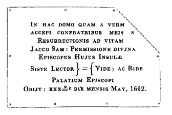
Manks Paper. The inscription given by us from Feltham's Tour, it appears is not a literal copy, and there is also an error in the date, as will be observed by comparing the above with that given. — See vol. i, p. 352.
56 Bishop Wilson's Description of the Isle of Man, ap. Camden.
57 Cregeen's Dictionary of the Manks Language, p. 132.
58 Keith's Historical Catalogue of Scottish Bishops, Edinburgh, 1824, p. 377. Hollinshead's Chronicles of Scotland, edition 1805, vol. i, p. 18. " This name has been corrupted into Braddan, which Challoner supposes to signify a salmon;" (ap. Wood, p. 111) but this fanciful derivation is incorrect.
59 Keith's Catalogue, p. 301.
60 Isle of Man Charities, p. 102.
61 There is a similar epitaph on a gravestone in the churchyard of Kirkcudbright, in Galloway, erected to the memory of a namesake of the vicar of Braddan : " Here lies the corpse of Patrick Thomson, deakon of the weavers in Kirkcudbright, who departed this life 6th Dec., 1775, aged 57 years." Thus he appears to be the present deacon of that body, although he died in the last century.
62 In a letter dated 20th September, 1844, from a highly respected correspondent in the Isle of Man, he says : — " Are you aware that the septennial appearance of the Island, said to be submerged in the sea by enchantment, near Port Soderick, is expected about the end of this month." Though the spell by which this fancified Island has been bound to the bottom of the ocean, since the days of the great Fin M'Coul. and its inhabitants transformed into blocks of granite, might, according to popular belief, be broke by placing a bible on any part of the enchanted land when at its original attitude above the waters of the deep, where it is permitted to remain only for the short space of thirty minutes: no person has yet had the hardihood to make the attempt, lest in case of failure the enchanter, in revenge, might cast his club over Mona also
63 Transactions of the Society of Antiquaries of Scotland, vol. ii, part ii, edition 1831, p. 503.
64 Respecting this inscription, Dr. Jamieson, of Edinburgh, makes the following observations: — " In regard to an inscription on a whinstone found on laying the foundation of the present church of Santon, it seems evident that N is a combination of A V, and that = is the contraction of U M. Thus I read it as barbarous Latin for Avitum Monomentum. The characters seem pretty nearly to resemble the old Teutonic, as given by Astle, table i, p. 64, and table xi, p. 84, which inscription he asserts to have been written in Italy above eleven hundred years ago, probably by some Latin priest." — Transactions of the Society of Antiquaries of Scotland, vol. ii, part ii, edition 1831, p. 499.
65 Campbell's Political Survey of Great Britain, Dublin, 1775, vol. ii, p. 534.: In the Gaelic language, dubh signifies "black," and glass " white," which, when united, form the name of the town. In Bleau's Map of the Island, published at Amsterdam in 1658, there appears Douglas town, Douglas haven, and Douglas point ; but the streams above alluded to are called the black water and the white water.
66 Hume of Godcroft's History of the House of Douglas, Edinburgh, 1643, p. 20. The Isle of Man was peopled by the Scots, for to this day the old language is spoken there, and has places named from the Douglases and others, who were notable families of the Scots, before Mr. Camden mentioneth any progress of the affairs in,the Isle of .Man. — Irvine's Historical Scoticae Nomenclatura, Edinburgh, 1682.
67 On this subject the following interesting extract of a letter from the Rev. Edwd. Craine, vicar of Onchan, will be found to supply all that is accurately known on the subject: — " In respect to the civil and ecclesiastical limits of this parish and Kirk Braddan, in the former jurisdiction we include the whole of Douglas, but in the latter we only go as far as the stream at the quarries, near the sands, and which supplies the town with water. But some are of opinion that we extend as far as the rivulet near Mrs. M'Crone's house. This is, however, doubtful. When a person residing in Douglas is cited in the deemster's court, he is called an inhabitant of Onchan ; but when the same individual is cited in the vicar-general's court, he is called an inhabitant of Braddan. This is a very strange distinction, and cannot be satisfactorily accounted for. " — Laughton's Historical and Parochial Guide, p. 108.
68 Even in the Chronicles of the Kings of Man the word Douglas is only once mentioned, and that with reference to the removal of the Monks from the Abbey of Rushen to that of Douglas ; but this is known to be incorrect, they only removed from Rushen to the Friary of Bowmaken [Incorrect - the Friary postdates the Abbey by almost 200 years]. So far as we can learn, there never was a monastry at Douglas. If the Chronicles of Man were written in Norway, as it is supposed [again incorrect]- written at Rushen Abbey they were, such a mistake might easily happen by the author not knowing exactly the topography of the Island.
69 Ante, vol. i, p. 254 — vol. ii, p. 78.
70 The late Duke of Atholl set the example of building good houses in the Island for lodgings. He erected the first four houses on the Crescent, and let them furnished at a moderate rent. To those who build houses there, the feu duty is three shillings per foot.
71 During the erection of this church in 1833, Mr. Skillicorn, the builder, said to be the wittiest wag in the parish, caused the gravestone of Elizabeth Hayes, which has a peculiar inscription on it, to be taken from the churchyard and placed as one of the pediments of the spire, for the purpose of puzzling posterity. In March, 1838, the British government granted the sum of £130 towards the erection of the parsonage house of this parish.
72 " From ancient records, and such authorities as can now be obtained, it appears that the loss of life and of property from shipwreck, on the coast of the Isle of Man, has at all times been awfully great. By an accurate and attested list which accompanies this memorial, it will appear that from the year 1821 to the present time, the vessels totally wrecked or stranded on the shores of the Island amount to upwards of one hundred and twenty — that above one hundred and sixty lives are returned as lost, and property to the amount of two hundred and fifty thousand pounds. That in the immediate vicinity of the great port of Liverpool, during the tremendous hurricanes which sometimes sweep the seas, many large and valuable vessels, unable to find shelter on those perilous shores, are frequently wrecked, and but too often their numerous passengers and crews inevitably perish, when a refuge might have been found in Douglas bay. And it has been further estimated that within the last ten years more than one thousand persons have perished, and property to the amount of one million sterling has been lost by shipwreck in those seas by which the Isle of Man is surrounded." — Extracted from a Memorial to the Lords of the Treasury, in favor of the erection of a central harbour of refuge in Douglas bay, agreed to at a numerous meeting held in the court-house of Douglas on 18th March, 1845.
73 See Sir William Hillary's work on that subject, published at London, in the year 1823.
74 Townley's Journal, vol. 2, p. 223. In 1797, the sum of.£7000 was granted by government for the completion of the pier and repairing the harbour. In 1798, the sum of £3,500 was voted by the House of Commons to be expended on public buildings in the Island. Feltkam, p. 229.
75 On 10th January, 1845, according to the almanack, the tide, which was at its height about twelve o'clock, should have risen eighteen feet seven inches ; but owing to the strong southerly wind which prevailed, it rose several feet higher. At twelve o'clock, the water had covered the tongue, and had overflowed the north quay, in some places half-way to the houses. At Callow-slip the sea flowed up into Duke-street, rendering that thoroughfare impassable for some time, but not damaging property to any great extent. About half-way down Strand-street, where the backs of the old houses abut on to the beach, the unusual rise of water, and the heavy surge which attended it, did some injury — in one place breaking in a wall, knocking down an old smithy, and undermining the outer corner of a somewhat dilapidated, but occupied, dwelling house.
76 Malte Brun's System of Geography, edition 1832, book cli.
77 Bennnet's Sketches, London, 1820, p. 8.
78 Harrison's Description of Britain, p. 38; Speed's Theatre of the British Empire, folio 91.
79 Oswald's New Guide, p. 84. Pomponius Mela speaks of an island called Sena in the British sea, celebrated for the oracle of the Gælic divinity, whose priestesses, nine in number, enjoyed the faculty of raising the wind and the sea by verses, of predicting futurity, and of changing themselves into animals. — Mela de Situ Orbis, lib. iii. ; ap. Dalyell's Darker Superstitions of Scotland, pp. 250, 251.
80 These buildings, called the Wellington Market, were first opened to the public on 20th of January, 1838. The greater part of the stalls were let by auction, from that time till the 20th of November following, at a rent averaging about seven pounds each; but such is the self-willedness of the country people that they never avail themselves of it, though they could do so without any charge or toll; they prefer standing with the produce of the dairy or fowlyard in a small dirty square near to the harbour. Once, on asking the reason of this, we were answered by a native that she " could get a better price for her stuff on a wet day, as the English and strangers would not stand chaffering with her in the rain." — Liverpool Albion.
81 The population of the Channel Islands, although only about 60,000, support twelve newspapers, eight of which are published in Jersey, and four in Guernsey. — Pigot's Commercial Dictionary, p. 172.
82 Appendix, Note iii, " Manks Periodical Press."
83 The contributions of the Ladies' Soup Dispensary, commencing November, 1843, and ending June, 1844, amounted to £383 10s. 10d. ; the donations to it — two hundred and six pounds of beef, and a large quantity of vegetables. Annual Report, published 9th November, 1844.
84 Life of Bishop Wilson, av. Bullock's History, p. 179, 410. I may, however, here remark that there are several benefit societies in Douglas, and in other parts of the Island, which often afford great relief to their members and are seemingly in a flourishing state. The funds of the Kirk Onchan Friendly Society, amounted at Whitsunday, 1838, to the sum of £1560 12s. 11d., having increased £84 in the preceding year. The funds of the Kirk Christ Rushen Friendly Society increased in the same period £80, and the funds of that of Kirk Michael £14.
85 Appendix, Note iv, " Aversion of the Islanders to Vaccination."
86 There are at present several naval officers in the Island who rose from before the mast, one of whom, impressed out of a collier in Castletown harbour, became Nelson's first lieutenant at Trafalgar.
87 Appendix, Note v, " State of Education, &c."
88 This ship was a present from Earl de Gray, when first lord of the admiralty, to Bishop Ward, who fitted it up for its present use at his own expense.
89 Isle of Man Charities, printed 1831, pp. 115, 116, 117.
90 Tour in the Isle of Man in the year 1836, by a Stranger, p. 67.
91 The following is an abstract of balances of depositors' accounts, on 31st Dec., 1844: —
194 accounts, whose respective balances (on 31st December,
1844, including interest) did not exceed £ 5 each .. £ 442 17 9½
106 accounts above.£ 5 and not exceeding £10 734 8 3½
134 accounts above £10 and not exceeding £20.. 184 7 6 9½
70 accounts above £20 and not exceeding £30.- 1691 17 1½,
124 accounts above £30 each 6229 17 0½
628 accounts amounting to.. £10926 7 0½
— Report of the Isle of Man Bank for Savings, 30th Jan. 1845.
92 Bullock's History of the Isle of Man, London, edition 1816, p. 206.
93 Encyclopedia Britannia, 4th edition, Edinburgh, 1810, vol. iii, p. 291.
94 Appendix, Note vi, " Incidental Sketch of the Isle of Man Joint Stock Bank."
|
|
|
appendices |
|
|
||
|
Any comments, errors or omissions
gratefully received The
Editor |
||