View in upper Sulby Glen (Ashe 1825)
[From A Manx Scrapbook]
Lezayre is the largest parish and the most abruptly diversified in contour and scenery. The highest land and the lowest, the richest and the barrenest, the longest river and most of the Curragh, the greatest glen and the loveliest, all these are hers. Ages before she was made a parish the sea retired from the feet of her hills ; their waters followed it North-Westward, wearied, and found it again in the East. Since she was fashioned and christened the mouth of the same river has been straightened Southward the better to feed Ramsey. Within her boundary are the broadest desolate spaces ; yet for the fertility of her alluvial soil she has rightly been called the Garden of the Island.
Ramsey. Though the 13th-century spellings of the name in the Chronicon vary between Ramsa and Ramso, the former is the more frequent and there is an accusative Ramsam ; that these and the modern Manx form Rumsaa, with accent on final, are to be referred to a Scandinavian Rafns-vad, " Rafn's Wading-place," and not to oe, an island, is clear from the Ramswath in Alexander of Scotland's Grant of the lands of Holy Trinity, Lezayre, in 1235. This is supported by the treen name Ramessay in 1510, and by the spelling of the town's name as Ramsway in Durham's map of 1595, published in Speed's Atlas, 1610.
Cur Dhoo, i.e., Creg Dhoo, " Black Rock," is a large and conspicuous shore-rock at the Northern end of Ramsey Bay, well-known to fishermen.
Croit Vess, " Bess's Croft," " now Lowdes's Garden, a dwelling-house formerly." These two names, occurring in documents dated 1782 and 1815, belonged to ground at the top of Ramsey Harbour which has long ceased to be either a croft or a garden.
Cronk y Croghee, " Hill of the Hanging," is the name of the point of the cliff at the North end of the Mooragh Park, above the old river-course.-(Dr. Tellett, Lioar Mann., ii., pt. i.) It suggests, without necessarily implying, episcopal jurisdiction here, since the Bishop's Baronies were originally held cum furcâ. Land called " Ramsey " was included among the Bishop's Baronies in 1505.
Cronk Ruagh, " Striped Hill," is on the Jurby road near Ramsey, ; Gaelic riabhach, as also in Drom Rewach treen, Michael parish.
Glion Cro is the small cleft in the hills immediately
above the Crossags, West of Ramsey, now known by
the English equivalent of " Nut Glen." From it flows
Struan ny Crawe (O.S. map), which would mean
" Stream of the Bone," but perhaps the name is rather
to be associated with that of the foregoing glen.
Though now but a narrow and disciplined brooklet, it
marks for the greater part of its course the boundary
between Lezayre and Maughold, and between the
Sheadings to which they respectively belong. It was
thus a meeting-point of the Northern and Southern
halves of the Island, according to the old method of
dividing it. In all these important duties it would
seem to have usurped the natural prerogative of Ballure
Glen.
Cronk Knowle, " a circular mound of earth situated in a field North of Balleigh."-(O.S. Name Books.) This appears to be what is otherwise known as Cronk yn Oe, or more fully Cronk Beg yn Oe, probably so-named from the family called Christian " Noe," i.e., Christian the Grandson, which flourished in the neighbourhood.
Glen Aldyn. As regards this name, we have the choice of three views : that the Norse Altadale of 1513 was an adaptation of the Manx Glion Aldyn or something similar ; or vice versa,- or that they had no connexion with each other beyond relating to the same valley. Perhaps the last theory, that of their mutual independence, is the most plausible. The two names were in use concurrently at one period, for two distinct mills were called in the 17th century Altadale Mill and Glen Auldyn Mill. At the same epoch occurs the spelling Glen Olden. Doubtless the Norse name of the glen lost its vogue after the disuse of the language and survived only in documents, as did Wardfell for South Barrule, Rozefell for whatever was the Manx forerunner of " Windy Common," Bordal for Glen Wyllyn, etc. Glen Alten in Conchan parish, though not numbered in Wood's Atlas, is situated on the West side of the Mountain Road below Keppel Gate. By a coincidence it, likewise, debouches into a Sulby river. That both these names have their source in alt, a mountain stream, as stated by Moore, is more than I should venture to affirm.
The main vein from the Snaefell Mine is supposed to lie hidden in Glen Aldyn. I have heard that it was discovered there during the nineties, but as another man held a licence to work the spot, the finder, not being offered a fair price for his discovery, refused to divulge the secret. The licensing law, I am told, is now adjusted more equitably; if a holder does not work his claim within a certain time the licence lapses.
The charm of Glen Aldyn has suffered from itsproximity to Ramsey, but I am not at the moment
concerned with conveniently situated villas. At its
entrance is
Magher y Troddan, " Field of the Contest." Whether
the contest was the historic battle of Scacafell and its
Eastern approach legend has not informed me, but the
field is said to contain an ancient cemetery. At any
rate, it was a haunt of the fairies, which is often
significant of early interments. The Tarroo-ushtey who
used to come out of the river and disport himse f in the
meadow has not been seen since the Volunteer. used it
as a summer camp for several successive yeas s. The
conjunction of a river, a water-mill or two, a reputed
burial-ground, and an avenue of overshadowing trees,
combined to make " Milntown Corner " a place to be
hastened through if the night were dark ; but it is hard
to distinguish now among the various vague shapes and
presences which haunted it. The one most definitely
reported was the inevitable Moddhey-dhoo ; a Cabbylushtey or Water-horse lurked there as well as the
Tarroo-ushtey aforesaid, also a Cabbyl-oie or Nighthorse, a near relation of the Cabbyl-ushtey if not
actually the same creature. Even a human inhabitant
of the big house there added, many years ago, to the
terrors of female wayfarers, both in his lifetime and
afterwards. Let us then leave Milntown Corner behind
as quickly as possible, and proceed to the pleasanter
consideration of
Glion ny Billey Gorrym, " Glen of the Blue Tree "
or mountain-ash, somewhere in the neighbourhood of
Glen Aldyn, under the branches of which the Fairy Prince conducted the courtship which led to his disgrace
and transformation into the Fenoderree, in the tale
exploited by several embellishers of Manx folk-lore. Like
many another pretty fairy-tale, it has an air of having
been made to wear clothes and go to Sunday-school.
Glion ny Billey Gorrym cannot be vouched for as an authentic place-name ; that there was a venerated tree in this locality, as in many others in the Island, need not be doubted, but its site is now uncertain. The late A. W. Moore made unsuccessful enquiries about it, and Charles Roeder told me in 1901 that he too had been unable to ascertain its former position. It has been ascribed to a tract of land in the Eastern fork of Glen Aldyn called Magher Glass, and I have been told locally that a place near the Spooyt Vooar below the Neary " was once called the Billey Gorrym." In the Lord's Composition Book of 1703 there is mention of a quarterland called Ballavilly, whose name implies the presence at some time of a tree of remarkable qualities ; though not within the limits of the glen proper, the farm was adjacent to its river, and might possibly provide a clue to the lost tree.
Gorrym, though usually translated by " blue," seems to have been applied to fairly deep shades of colour between blue and green, while glas was used for lighter tones of the same hues. The confusion may not have been wholly unintentional ; in parts of the Hebrides blue was sometimes substituted for green in terminology, because green was a colour specially favoured by the fairies and therefore taboo to mortals. There is still, of course, a prevalent belief that it is unlucky to wear.
The Western wall of Glen Aldyn is politely and cartographically called
Sky
Hill, but on the lips of the people it is " Skyall," accented like " trial."
This is not a case of h-dropping, but comes a little nearer to the Scandinavian
original. As befits the scene of the battle of Scacafell, " Jutting Hillside,"
between the Manx and the Norse, described in the Chronicle at 1076, it is dotted
along its ridge with burial-mounds, not all of which are likely to be due to
that historical event. Indeed, there is, or was a couple of dozen years ago,
a feeling-one can hardly call it more-concerning this hill which suggests that
it was once occupied by a fundamental stratum of the population, confused or
identical with " the Fairies." One of the farms on top was held to have been
" the first house " (or " the oldest house ") that was ever lived in in the
Isle of Man." Moreover, " the fairies had a regular city up there." Though most
legends are liable to diffusion, I have not heard this definitely asserted of
any other place, though there is a general notion that " the first people lived
on the mountains."
Kelly, in his Sketches of the Isle of Man, 1844, thus reports or redecorates the Glen Aldyn tradition as it existed in his day: "Away to the left is Sky Hill, renowned for the numerous battles which were fought in its vicinity during the early periods of history. It is said that a noble fortress once stood upon its summit, but now it is an undistinguishable heap of ruin. The sheep browse over it, and the shepherd makes his pillow where formerly proud warriors and noble dames oft met in chivalric pomp, and the chieftain held his feudal and barbaric court." To this may be added the earlier and more sober statement of Waldron : " As they confidently assert that the first Inhabitants of their Island were Fairies, so do they maintain that these little People have still their Residence among them. They call them the good People, and say they live in Wilds and Forests, and on Mountains."
Creg Bouyr or Creg Keeill Bouyr is a narrow ridge of outcrop about 20 yards in length. " Deaf Rock " or " Rock of the Deaf Church " is the meaning assigned ; deaf, that is, by inversion, on account of the silence of its inhabitants-it is a place of interments. But this seems too fanciful to be quite satisfactory ; and there is a Glen Bower in Braddan parish. The word is fairly common in Irish place-names, and Joyce, ii., 46ff, gives it this-the ordinary Irish colloquial-meaning, but confesses to being puzzled by it. Concerning one of the Irish Glen Bowers he quotes a statement that it has a remarkable echo, which reminds me that Feltham, Mx. Soc. edition, page 147, mentions " a remarkable echo on the North side of Skyhill," without locating it more exactly. " Echoing," due either to repetition of sounds or to hollowness of the ground beneath the foot would be a more satisfactory explanation than " deaf," if it could be established by tests. Unfortunately such phenomena are apt to disappear in the course of natural and artificial change.
Cronk Alisha is another burial-mound. The second word is a woman's name which in the Isle of Man became merged in the English " Alice," but I do not know of any reason why it should be applied to this tumulus. Aillse, a Scottish word for a fairy, is not used in the Island.
Cronk Crock is a pointed outcrop of rock, also on the ridge of Sky Hill, and having early interments in its vicinity, I believe. The name, together with Creg ny Crock, Glen Rushen, is puzzling. The Irish cnoc, which would give crock in Manx, means wild cabbage, according to O'Reilly ; but plant-names vary in their application in different regions and epochs, and if this is the true derivation, some other plant may be concerned.
Magher Hooigyn, " Graves Field," contains a number of cists.
Before crossing to the opposite or South-East side of the Glen a practice may be mentioned-though it has already been given publicity-of gathering at a keeill-site on Ballameanagh, close to the bridge, on St. John's Eve about midnight. By the number of " lights " seen passing along the road, or seen by the side of the river, the watchers predicted the number of deaths which would happen in the Glen during the ensuing twelve months.
Glion Keeill Vael, " Glen of (St.) Michael's Church,"
preserves the dedication of a vanished treen-chapel.
The valley, now renamed, I think, " Fern Glen,"
extends from the Mountain Road to Balleighteragh.
In it is a field called
Lag-eel, which may mean " Church Hollow," but may also mean " Narrow Hollow."
The other Eastern fork of Glen Aldyn is now imaginatively advertised as " Niagara
Glen " ; the proper name of its " Niagara " is Brafost-Norse fors, waterfall,
and probably breidy, broad. The gorge in which it is situated has been recorded
as the
Gulley Mooar, " Great Gullet "-the Gaelic gulaid, frequent as gullet
in Manx place-names, both inland and on the coast. The ground above this place
was called
Magher Glass, " Greenish, or Greyish, Field."
Lag ny Darrag, " Hollow of the Oakwood," lies on
the steep side of Ballagarrow (locally pronounced
Ballagorra), on the West side of the river. Through
it climbs the zigzag track called Bayr ny Darrag," Road of the Oakwood." On the same farm is a croft known as
Keeill Phooigyn
or Phooigynagh, " Church of the Graves, or of the Graveyard," but of the keeill
nothing but this name remains.
Dreem Gill or Gell, the second element being the personal name, forms the continuation of Skyhill Southward. In the Ordnance map the name, which means " Gill's Hillridge," is attached to a valley near the head of Glen Aldyn. It happens that the narrow part of the Glen, above the cloth-mill, is also called the Gill, i.e., " the Ravine."
Park Watterson, like Dyeem Gill, is a tract of rough grazing ground above the Glen. There was at one time a Watterson family in Ballagarrow, though it is properly a Southside surname.
Glion ny Gownagh, " Glen of the Young Cows," known also at different epochs by the names of its temporary tenants-Cartwright's Glen, Quirk's Glen, etc.-enters Glen Aldyn opposite the Derry or Arderry.
The remains of a smithy hidden among the trees on
the left, about half-way up, date to the time of some
abortive mining there. At the top is Skyhill farm, long
abandoned as a place of residence, containing an old
horse-worked grinding-mill. Just beyond Glion ny
Gownagh going up the main glen, is
Broogh Brisht, " Broken Bank," which has slipped down and crumpled up through
the undermining action of water from the hill above. A few yards farther is
Clagh y Dooinney Maroo, " Stone of the Dead Man," at the edge of the river.
The name is commonly explained by a story that a man waylaid and murdered here
was afterwards waked by his murderers on the stone ; but it seems more plausible
that it was formerly a grave-slab brought from elsewhere and laid down at this
spot to give convenient access to the water, or to a row of stepping-stones.
Formerly the stream at its normal height washed the end of it.
Passing the Croit Veg, " Little Croft," on the riverbank, long a ruin, and the Creggyn Mooar, " Big Rocks,"
a conspicuous outcrop high on the opposite hill-side,
the next building is
Tantaloo, a croft and old tuck-mill by the stream. Coming down the steep track
just across the river used to be seen the figure of a woman in a grey cloak
and a white head-dress resembling a sunbonnet, and holding above her head a
frying-pan with which she would threaten people who were unfortunate enough
to meet her; for she was thought to be an evil portent. A spectre carrying a
frying-pan, and making such unconventional uses of it, ought to be unique ;
but in Tales of the Blackdown Borderland (Somerset), published in 1923
by Mr. F. W. Mathews, a volume which provides more than one striking parallel
with Manx folk-lore, there is on page 67 a description of " a lonely road which
passes under the hill down a steep little dip to a brook and an old ruined farm-house,"
whereon " mysterious shapes were seen . . . there were three women all dressed
in white, wearing sunbonnets, and carrying frying-pans on their heads." What
thing it was that looked to the beholders of these apparitions more like a frying-pan
than anything else within their knowledge is beyond my power to guess ; but
there is some obscure memory in folk-lore generally of a class of people who
wore an unusual and conspicuous head-dress. In addition to the foregoing, a
nocturnal procession carrying lights along the East side of South Barrule had
" something strange on their heads." Roeder tells of " three big Fairymen met
with on the Howe, with caps as wide as a wheel-terrible caps." And Thorpe, Northern
Mythology, ii., 277, gives the following Danish tradition: "If anyone goes to
church on Maundy Thursday, and has without knowing it a pullet's egg (i.e.,
the first egg a hen lays) with him, he will see all the women that are witches
with sieves or milk-pails on their heads."
A little farther up the glen than this small farm-house,
and on the right-hand side, is
Spooyt Wooar, " Great Spout," a steep rocky water
slide and fall in a thickly-wooded gorge, of some volume
and beauty- after wet weather. Above this rises
Creg ny Ghoayr, " Rock of the Goat," an elevated point
beloved of that tribe, and in the neighbourhood is
November Crag, said to be so-called " because the
sun does not shine upon it after that date."
Billey Shiaght ny Clagh, " Seven o'clock Tree," is another natural time-teller. In the same way the people in a district of Lochaber knew meal-time by the position of the sun with respect to a hill-top stone called Clack an Acrais, " Stone of the Hunger."
Gob ny Meayl, " Snout of the Hill." This and the two previous names were given to me by the late Miss Sophia Morrison, and I do not know the exact locality of the spots to which they relate.
Beyond the crumpled and water-seamed area in
which the Glen Aldyn river has its birth, and equally
near the head of the Cornaa Valley, stands
Clagh Ouyre (1,808 feet, O.S. map) or Slieu Ouyre,
which as the highest point in the Island after Snaefell
and North Barrule deserves consideration. The map
name, now generally used, is due to the remarkable
boulder just below the summit. The local pronunciation
comes nearer to " Clagh Or," and in some of the old,
though not the oldest, Lord's Rent Books for Lezayre,
there is a Slieu Our intack which probably lay at its
foot. But Feltkam (1798) and others call the hill
Slieu Coar.
The clagh which enters into the current name is a huge oblong boulder jutting horizontally into space like a gargoyle, near the top of the steep Western side. It has plainly split off the cliff behind at some remote epoch. Its upper surface would afford windy standing room for a squad of soldiers and cover for a regiment of rabbits.
Returning Northward out of the mouth of Glen Aldyn into the level lands, it may be mentioned that Cronk Mooar, " Great Hill," was the former name of " Bolivia Mount." The tumulus from which it was derived was a companion to Cronk Aust on the other side of the road.
Ballakillingan (O.S. map), " Farm of (St.) Ninian's Church," was in the 17th century Ballacarga or Ballacargie, and was owned by the family of Curghey, now Curphey. Particulars of their history are given in one of the old Manx Society's volumes, Illiam Dhone and the Manx Rebellion, pages 4 and 120. A little farther along the road Westward below hills which once were sea-cliffs, is
Lezayre Churchtown. The Fair originally held here was ordered to be removed to Sulby Claddagh in 1735 for lack of room (Moore, Notes and Documents), and has long been known as Sulby Fair. But Kennish in his poem, " The Manx Courtship," seems to date " the Fair of Kirk Lezayre " to a much later period. Either it did not move on when ordered or it retained its name for a while in its new surroundings as being the principal fair of the parish. The steep little valley above the hamlet is
Glion ny Killey, " Glen of the Church," whose waters flow under the floor of a house to reach the Sulby river. It is haunted in its upper parts by a Grey Lady clad in a robe of swishing silk. Glentrammon Woods a little farther on are likewise the home of a grey-silken Lady who was not of Eve's kinship though possibly of Lilith's ; or there may be but one Grey Lady, given to ranging the hills and sometimes walking the roads, for she has been met with on the highway too. Gob y Vunney above the quarries separates Glentrammon from Glenduff. If the last name is Manx the retention of the final consonant in " duff " is exceptional.
Ellan ny Foillan, " Island of the Seagull," is the name of a field on Loughan y Guiy in which a crannog or lake-dwelling was discovered.
Mirescogh, " Swamp-wood," has been conjecturally identified with Ballamona, on what ground I do not know. This Norse-derived name belonged also to the King's Chase, and still belongs to the township of Myerscough, in the Lonsdale Hundred of Lancashire. Out of the Chase the warden was expected to deliver annually a buck to the Chancellor of the Duchy, wherein it has been confused with its Manx namesake. " The Mires " was the usual term for the Northern curragh-land in the 16th and 17th centuries. The Lancashire name occurs as Mirsco in 1258 and Miresco in 1265 ; its Manx doublet is first recorded at 1176 in the Chronicon Manniae, when the site was bestowed by the King upon the Abbey of Rievaulx in Yorkshire. The " monastery " built there-doubtless a very modest establishment-was afterwards relinquished to Rushen Abbey, whose site, Camden states, had also belonged to Rievaulx originally. The anecdote relating to Mirescogh in the Chronicle at 1249 was evidently inserted for the sake of its edifying miracles and to discredit the usurping King, Harald son of Godred. An elderly native notable, a minion of the previous King, had been treacherously imprisoned by Harald in " a certain island which was situated in the wood of Mirescoge." One day the prisoner's (rust-eaten ?) chain fell suddenly and miraculously from his foot, and he found himself, through the intervention of a miracle, unable to replace it with a view to escape during the night. Concluding immediate flight was thus indicated, he gathered in his tunic and cloak and made off. The pursuing guard miraculously tripped over a stump and damaged his leg, and Donald reached the sanctuary of Rushen Abbey whence he had been cajoled, to tell his tale of miracles to the Chronicler. Goss, in his notes to Munch's edition, suggests that truncum ligni, the guard's stumbling-block, implies a crannog or lake-dwelling here ; but the " island "-these little green eminences, which must have stood dry, though not high, above the marsh then surrounding them, are still called ellan throughout the Curragh-was evidently accessible on foot, no doubt by a causeway of logs-trunci.
In addition to the glimpse herein afforded of the character of the local scenery, and of the native costume, in the 13th century, a point of interest lies in the evidence that Mirescogh had then relapsed to, or been seized by, the Crown ; and some soreness on this head may have prompted the insertion of Donald's adventure in the Chronicle. As Mirescogh is included among the possessions of the Abbey whose bounds are detailed in the additional matter at the end of the Chronicle, it may be inferred that these undated records, full of place-names now mostly obsolete, were not written after 1249, or very long before 1238, by which date, according to the Cartulary of Furness, Mirescogh had passed into the hands of Rushen. It seems likely that its lands were extended at or soon after the time of the transference from Rievaulx. It may be remarked, however, in respect to the dating of the Boundaries, that the form of words used in the delimitation of these Lezayre lands differs from that of the Malew and Lonan Abbey-lands in one particular : whereas the latter are in each case stated to lie within " the boundary between the land of the King and the land of the monks," the boundary of the Mirescogh tract lies " between Kyrkecust and the land of the monks." Kyrkecust is presumably Kirk Christ or Churchtown, but any land it may be supposed to have possessed at that date could only have marched with that of the monks for a very short distance unless we are to understand that the parish had already been constituted and endowed with, approximately, its modern area ; in that event, of course, the monastic territory would have formed an island within it, but its land would have been the King's land with the exception of the small tract at Kirk Christ belonging to the Bishops.
Close ny Mona, " Enclosure of the Turf-ground," above Narradale (formerly Nerindale), has for the last 30 years, to my personal knowledge, been the current name of the farm or croft labelled Cronkgarroo (" Rough Hill ") on the Ordnance Map.
Past several haunted spots, from one or two of which
the danger has been removed by highway improvements,
the road leads to the
Ginger Hall Inn near Sulby Bridge. An older form of this name is " Gringey Hall " ; it is evidently
derived from that of the estate on which it stands, the Grangey or Abbey farm. On the neighbouring farm, Ballamanaugh, "
Monks' Farm," is a further testimony to monastic ownership and possible monastic occupation in the name
The Monks' Orchard. Just outside this enclosure, on
the Narradale stream, is a vestige of one of the primitive
horizontal water-mills. Also on Ballamanaugh is
Carrac Hill or The Carrick, " The Rock," a
conspicuous feature not named on the maps. A
quarter of a mile West of "the Ginger" the road
crosses the river by means of
Sulby Bridge, which has undergone several widenings
since it was built in the middle of the 18th century,
and can now be traversed with less risk, even at night,
than was possible in the early 19th.
" Hardly anyone in the Island would cross a country bridge at nine o'clock at night, as at that hour they were all briefly occupied by witches. ' In one of my visitations round the Island, Mr. M-, a Manx parson, and my Registrar, was riding with me on his old gray mare. As it was nearing nine o'clock, and we were approaching Sulby Bridge, he was evidently in great anxiety, and kept hinting to me that it was time we pushed on. I knew what was in his mind, and out of mischief persisted in our slow pace. As we got close to the haunted spot, he pulled out his watch and so did I. It was just upon the fateful hour, and M without more ado, set spurs to his horse and galloped across the bridge as if Satan were at his very heels, leaving me shouting with laughter.' " (Our Centenarian Grandfather, A. G. Bradley, page 180 ff.) No doubt the idea was that the witches on their terrene travels were held up by the barrier of running water ; but why at that particular moment ?
Guarding the wide entrance to Sulby Glen couches
Cronk Sumark, " Clover Hill,"
Knock Shemerick in the 17th century; Ballashamrock in Braddan and Glen Shameroc
in Kirkcudbrightshire (Old Statistical Account) are comparable. In Scotland—Uist
particularly —seamyag na buadh, the four-leafed clover, is lucky to find, and
grows where a foal has been born. I do not know whether it was this kind of
clover which gave Cronk Sumark its name ; its conspicuous isolation would be
sufficient to invest it with the atmosphere of superstition which it has not
yet altogether lost. There used to be a custom at a certain time of the year—Good
Friday in later days-for women who felt in need of husbands to march in a circle
round the base of the hill at night, singing. Hence a byname for it was " the
Old Maids' Hill." What song these sirens sang, what raiment wore, and who was
expected to provide the victims, I cannot say. Possibly it was a mysterious
figure wearing a grey cloak and called " the Grey Man," who used to be seen
from below in misty weather, dominating the summit of his hill. The proverbial
saying, Tya ta'n gheay s'y villey yiow shiu yn Guilley Ghlas, now rendered "
When the wind is in the tree you'll be getting the Lockman," probably referred
not to that prosaic civil official but to the Grey Man who showed himself in
various places up and down the Island. A sudden stirring of the air is well-known
to herald the approach of invisible beings. There are special uses of geay and
billey which suggest that the true meaning of the dictum may lie below the surface.
After writing the foregoing paragraph I noticed what I should have remembered at first, that Roeder, Manx Notes and Queries, page 37, offers a different explanation of the proverb. But whether " lockman " is the Norse lagman, law-man, or takes his name from the " lock " of meal to which, as executioner, he was entitled in Scotland, a translation into Manx based on glas, a door-lock, is highly improbable.
If the Guilley Ghlas was not the object of the old maids' supplications, their procession round the foot of the Cronk gives one the idea that there may once have been either a pagan monument or a chapel, shrine or cross on the summit.
At the time the quarries were in operation which have done so much to disfigure the shape of the hill, and yet have helped to give it the remarkable sphinx-like outline it now presents from certain aspects, the quarrymen found from time to time certain fossils resembling fish, which they called braddan, salmon, and regarded superstitiously as " signs."
On the left after entering Sulby Glen is
Daleveitch (O.S. map), pronounced " Dal y Vitch," two conjoined crofts.
The Scottish dail and dal, as first elements in names, signify a field bounded
by a river and a hill, which is an exact definition of the land of this little
farm ; but the possibility of Dal y Veechagh,"Portion of the Inn-keeper "-Gaelic biadhiach-is
worth bearing in mind, in case of corroboration by
traditional or documentary evidence.
From here onward the most interesting feature is the number of rocky watercourses which rib the two sides of the valley.
Alt ny Bag is the steep and narrow stream which falls into the Sulby river from the East, opposite Killabraga Cottage. The name may be compared with Cronaback in Rushen. If alt here is to be understood as " mountain brook," bag is probably the Gaelic baic, a bend, or possibly the Norse bakki, a bank, adopted into Manx. In either case it is uncommon in the Island. A little farther on, the
Struan Reeagh, " Lively Stream," strings its white cascades down the rocks above the West side of the road and subsides into the Sulby, after marking throughout its course the boundary between Killabraga and the Craigmooar. On the Craigmooar, Jenkinson in his Guide reports, shortly before 1874, the presence of two women unable to speak English. They must have been nearly the last.
Ballaskella (O.S. map), " Wood Farm," lies high on the East side of the glen. A common-place story connected with it may be repeated here, if only for the sake of a picturesque phrase. A friend of mine, when a young man living and working on Ballaskella, was going home from Sulby up the steep zigzag road to the farm-house about two o'clock one very dark and foggy night, when a great dog nearly as big as a calf, whose " eyes glittered like the stars," came up behind and followed him, growling terribly. He, being as matter-of-fact in his youth as he now is in his seventies, turned round from time to time and tried to hit it with his stick, but missed it with every " skutch." Though not afraid, he thought there was something unusual about it, and mentioned it to his employer the farmer next morning, fearing it might do harm to the sheep. The farmer said he had seen the same thing himself a number of times ; there was no fear of its worrying the sheep, but there was " something not right " about it, and it was best left alone. My friend never went up by himself late at night afterwards, but preferred, if belated, to stop in Sulby till the morning.
This is a fair specimen of innumerable stories to be heard all over the Isle of Man, and not unknown elsewhere.
On the West face of Ballaskella is
Skella ny Ghoayra, " Wood of the Goats," an almost perpendicular ravine
made impenetrable by trees, rocks and water. The first element in the name is
pronounced " skellya " as in Ballaskella, and perhaps should be spelt so. The
inflected genitive plural is unusual.
Paris Gill, to the North of Ballaskella, is a bit of foreign nomenclature
due to an owner of the farm, who gave the name of " Paris " to a piece of grazing-ground
previously called
Booilley Glass, " Green Cattle-fold," and the " Gill " was added afterwards.
On the opposite side of the main glen, under the Sherragh Vane, is
Struan Daa Billey, " Stream of the Two Trees," though I suspect that
daa has in some cases a meaning which is ethical or superstitional rather than
numerical. Can it be related to the Old Irish dag and Welsh da, " good " ? I
was told a few years ago that an aged and still-respected tree stood near the
top of the gill, but have not yet climbed to look for it, for lack of a guide.
Blockeairy (O.S. map) is the house at the top of the high, narrow pass between Slieu Monagh and Snaefell. The name, which was virtually the same in the 17th century-Blockayry-is probably to be translated " Black Shealing." Of similar names in Co. Waterford Power says (Place-names of Decies, page 24, etc.), " the word blac is apparently loaned from English, to denote dark peaty soil," land reclaimed from the moor.
Lhingey ny Kay is in the Sulby river below Tholt y Will, where there is a barrier across the stream. The name appears to be equivalent to " Pool of the Mist," but I have been told locally that " kay means something between two other things " (query, a. dam ?), and there I leave it. The Ramsey Saltworks bought the field adjoining with a view to generating electric current by means of water-power, but fortunately made no use of it.
Dockspout Bridge is Jenkinson's name (Guide to the Isle of Man, 1874)
for the bridge which carries the road across at Tholt y Will. I have not met
with it elsewhere. The Manx name is
Droghad y Cabble, " Bridge of the Chapel," written " Druid a Whapple
" by T. E. Brown at the opening of his poem " Kitty of the Sherragh Vane." The
Chapel stands adjacent. The Bheim y Fheeah, " Leap of the Deer," mentioned but not located by
Moore, Manx Names, is a spot on the river just above here.
Tholt y Will (not named on Ordnance map) was Tholtar Willy in 1704. The present full name of the estate is Tholt y Will and Alt, which a descendant of a former owner tells me should be Tholt y Will yn Alt. This is one of the places which is made the scene of the Fenoderree's chase of the hare under the impression that it was the smallest and most elusive of the sheep he was folding for the farmer ; but Tholt y Will has an advantage over other localities to which the saga is ascribed in that the remains of the actual fold can be pointed out by an old kiln near the junction of the two small glens on the estate. Scottish localizations of the story are nearly as numerous, in proportion, as the Manx, and Scandinavian and Continental versions are to be found. J. F. Campbell, relates in West Highland Tales an anecdote he picked up in the Isle of Man which turns the usual Fenoderree story inside out, by making the swift-footed one to be the young son of a farmer, who comes home to tell his father that he has found a troublesome lamb among the sheep he has been folding, which was, though he did not know it, a " glashan " (glashtyn) in disguise. This comes much nearer to an old Welsh version in the Mabinogi of " Peredur and Evrawc." Peredur was the youngest and only surviving son of seven ; he lived alone with his mother in a remote spot, and went into the forest every day to play. One day he met his mother's flock of goats with which two kids were running, and he was surprised to see that the kids had no horns like the others. Feeling that something was wrong, he undertook the task of running then down and penning them in the goats' house at the end of the wood, and having accomplished this by his activity and fleetness of foot he went home to tell his mother what he had seen and done. "Mother, I have just seen something wonderful! Two of your goats have been running wild so long that they have lost their horns, and you don't know what trouble I had to drive them back into the goat-house." The mother and her servants went out to behold this wonder, and were overcome with astonishment to find what the child had done. Such is the gist of the passage in Loth's French text ; for his " kids " Lady Guest in her rendering has " hinds," which would add to the difficulty of the boy's feat. What animal was actually intended I cannot say. Loth is more likely to have translated correctly, but having regard to the glashtyn in the Manx story, possibly the Welsh word in question may have signified some supernatural creature.
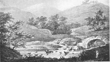
View in upper Sulby Glen (Ashe 1825)
On Tholt y Will are
Alt ny Creggyn, " Stream of the Rocks," and another torrent called simply the Alt. Near the head of the latter is the site of the farm-house anterior to the present one. It was for the building of this that the Fenoderree carried the big white boulder up from the sea-shore ; but even he must have failed to get it beyond the bed of the stream near the old stables, for there it still lies.
Struan Arick flows between the Forester's Lodge (formerly the Eairy) and the Sherragh Vane. " Arick " is said by a local informant to have been one Eric Corlett who lived there towards the end of the 17th (query 18th ?) century, and left descendants in the district, notably the once-celebrated Nan Willy whose name has adhered to a well near the Chapel; but Averick and Arick were usually feminine names in the Isle of Man. In the manuscript Lord's Rent Book for 1877 and other years there is a Leany Averick intack, " Averick's Meadow," in Middle Third treen, which is probably the secondary source of the river-name. The name of the Eairy estate (actually in Michael parish), which is partly bounded by Struan Arick, was altered many years ago to " Forester's Lodge " after the flight of its owner from the Island, consequent on some unusually extensive transferences of sheep from a neighbour's flock to his own. Another version says he was hanged, and was the last man to suffer that penalty for sheep-stealing. The land, after further changes in proprietorship, passed into the hands of Captain Bacon of Seafield. At the Close, across Druidale and in the parish of Braddan, one of the remotest habitations in the Island before it fell into ruin, dwelt a famous pioneer of the " local preachers," if indeed he were not the originator of that respected avocation. " Illiam y Close " from his place of residence, by calling he was head gamekeeper to the Duke of Atholl. His son, a mason, is traditionally credited with having built the greater portion of Parliament Street in Ramsey, and with having thrown the first arched bridge over the Sulby river.
On the South-West side of Tholt y Will is
Glion ny Gowan or Glion Gawne, "Glen of the Smith," with its picturesque pools and falls. At the Northern apex of the Close lies
Cosh ny Hushtaghyn, " Foot of the Waters," the confluence of the Druidale and Crammag streams, which unite here to form the Sulby river. Cosh ny Hushtaghyn is unique as being the meeting-point of three sheadings, three parishes, and three intack - farms - Druidale, Crammag, and the Close. There are said to be the remains of a keeill on the cliff-side just above the water; at all events there is the den (of which I should like to hear the name) of some other-world creature in a concealed hollow near the foot. A story to the following effect was in circulation some years ago in various forms, and even found its way into print, an exceptionally audacious feat for a piece of Manx folk-lore. Jack-theGiant-killer lived on the East side of Slieu ny Fraughane, and was a great boy for hunting and killing the " purrs " -wild and half-wild pigs-which infested the district in those days. Now there was one tremendous old boar purr, called the Purr Mooar, that had long been a terror to the living, and it was not safe for any person to pass alone over the Rheast-" the Desert "or through Druidale. So my Jack determined to rid the land of him. He made his way down to a deep glen through which the water was tumbling among the rocks below the Crammag, where the Purr Mooar had a lair near the river. After along and desperate struggle Jack laid him low at the cost of a wound in his thigh from the boar's tusk ; this turned out to be poisoned, and my poor Jack went on a crutch for the rest of his days.
" It is remarkable," says William Hackett of certain Irish boar-slayings (Trans. Ossianic Soc., vol. v., page 62, note), " that these legends prevail at sites which in Hindostan are considered sacred-the junctions of rivers." Jack in the Manx stories replaces, nominally at least, Finn MacCumhail in the Irish ones, and I think Finn must have been their Manx protagonist at an earlier stage ; but Finn was not the only heroic pig-hunter in Ireland, and may not have been the first one in Mann. One of the Bodley Dinnsenchas (Stokes), runs as follows : " The hounds of Manannan MacLir and the hounds of Mod, from whom Innsi Mod are named, met together around the pig that devastated the land about them, even Innsi Mod. Unless the hounds had come between them and the pig it would have been a crialhar as far as Albion, that is, it would have been a desert. The pig sprang before the hounds into the lake. The dogs ran after it. It pressed them together on the lough, and not a hound escaped from it alive without mangling. After that the pig went to the island which is on the lough. . . ." It is worth while digressing for a moment to note-even at the grave risk of its having been pointed out before-the resemblance in both matter and style of this scrap of medieval Irish folic-tale to the Hunting of the Twrch Trwyth, that paragon of pig-sticking yarns, in the Mabinogi of " Kilhwch and Olaven," and more especially to its closing incidents. After laying waste a fifth part of Ireland (Leinster to wit) the Boar is eventually driven by Arthur and his party, with the help of the chosen " dogs of this Isle," across South Wales to the confluence of the Wye with the Severn, where he is dislodged from the land by Manawyddan ab Llyr and three other warriors and soused in the Severn estuary. After redoubled efforts he is finally hunted out of Cornwall into the sea.
According to a tale current in Train's day (Account of the Isle of Man, i.,16) the last wild purr was an extraordinarily large and savage monster, who carried off sheep and lambs to his den in the mountain of South Barrule. His depredations among the surrounding valleys aroused the people to beset him with the fiercest dogs they could procure and hunt him from Barrule over the high cliffs of Bradda Head. The North has preserved a vaguer, and hitherto oral, version of its own, which is to the effect that a pig of abnormal elusiveness and perversity led its hunters a chase from Skyhill in Lezayre to Maughold Head, where they arrived just in time to see it roll over the cliff and change into a great fish as it struck the water. There is some uncertainty as to what this pig actually became when it reached the coast, and the forgotten word may be " porpoise " or its Manx equivalent muc-varrey, literally " sea-pig." If so, it was merely a case of a land-creature making the necessary slight change into its marine counterpart ; for " whatever there is on the land is to be found in the sea too," is the Manx belief. The resemblance to the horse ridden by Tehi Tegi, which in Waldron's story took to the water in the shape of a porpoise, will suggest itself to the reader , to the same polymorphous company seems to belong one " Jimmy Squarefoot " (to be met with later, in the parish of Malew) who in the form of a pig was ridden over land and sea by a giant and giantess living on Barrule.
The Rheast Mooar of the foregoing Manx version of Jack-the-Giant-Killer comprises
Glion Rheast, " Desert Glen," and its stream, Awin Rheast, which flows down from Slieu I'raughane through uncultivated heath-land into Druidale, the name of which was formerly Eairy Horkell, " Corkill's Shealing." All these places lie across the boundary in Michael parish. A little farther up the Crammag river than Cosh ny Hushtaghyn is
Lhingey ny Gavvag, " Pool, or Gulley, of the Dockweed." The river itself formerly bore the name
Awin Dhoo, " Dark River," from its being deeply stained at certain seasons by the peat out of which it flows. It is also thickly overshadowed by trees as it approaches the Druidale river. There is in it a deep place of evil repute where no man has been known, legend says, to fish more than once, or to have caught any of its fish, which are dark-coloured like the water they live in. One who had the hardihood to challenge the diabolism of this pool was found, after a night's search, lying unconscious on the bank, and was with difficulty revived and borne to the nearest house. He afterwards told a strange story to the effect that after hooking and losing a fish, as twilight began to gather round him he saw a red pole slowly erected from the surface of the water, and innumerable small creatures in scarlet jackets climb it and vanish into the air, to reappear a few moments later stained with blood. Their aspect and expression gave him the idea of soldiers after a battle.
I should have hesitated to quote this dubious adventure, even in abbreviated form, if I had not noticed a similarity of outline in another which is related in detail at page 166 of the Folk-lore Journal for 1888. A wizard at Langwell on the river Oikel in Sutherlandshire was applied to by a Mr. Ross to show him the spirit of one of the latter's ancestors. In a flat meadow by the river a circle was drawn, and Ross was instructed to stand on a white stone at the centre. The wizard then retired to his but to perform the invocation. The harvest moon was full, and at midnight a spectral army began to move from the watcher's right hand towards the river ; regiment after regiment wearing bright foreign uniforms passed him silently. At length his ancestor, Captain William Ross, appeared at the head of some of the soldiers, and asked him to join them, but he refused. The Captain then returned to his company and they all vanished into the Oikel.
One ingredient in the Manx tale which is not present in the Scottish version-if indeed they can be called versions of the same legend-is the disappearance of the figures into the air and their blood-stained return. This is evidently a retelling of the well-known Indian fakirs' trick, a variant of which is performed by " O'Donnell's Kern " (Silva Gadelica) who is an incarnation of the fantastic mood of Manannan Mac Lir. To these insinuations of detached fragments of folk-tales into other folk-tales there is no limit. The same story provides another example, which is a constant feature also in Manx and other accounts of the Fenoderree or Brownie. To the Kern, in return for his services in amusing the company, O'Donnell offers a jerkin, a hat, a striped shirt and a mantle. " But the Kern refusing the same said : ' I will not have it [the suit of clothes] ; nor shall any that is of gentle blood ever have wherewithal to taunt me.' " For the costume was that worn by men of a low class. We are not told why the Fenoderree refused the outfit proffered by the grateful farmer, but one account of him makes him a fairy prince in disguise, and " if these be thine, thine no longer is the merry Glen of Rushen," where the fairy king held his Court.
The Thief's Glen, also known as " the Devil's Glen," is a shallow valley East of Glen Crammag. The Manx of " Thief's Glen " would be, and here probably once was, Glion Maarliagh, a name which actually occurs in the parish of Patrick, and doubtfully in that of Michael. The thief was not necessarily one who robbed the immediate neighbourhood ; the sufferers would, one surmises, have dealt promptly and severely with him. In any case, when the Island was more insular than it is now, robberies were confined almost wholly to sheep stealing. In the Book of the Customary Statutes, put in writing by the Deemsters at the Lord's command and proclaimed in Tynwald in 1577, is a decree that no one on the North side should give shelter to a thief from the South side, and vice versa.- (Statutes.) Hence such a man would be an outlaw, and obliged to take refuge in wild, seldom-visited places, as these three glens notably are.
Glion ny Ghoayr, " Glen of the Goat " ; then comes
Glion ny Venn (slender
" n "), " Glen of the Hilltops." Though I have preserved a uniform spelling,
" gliown," rhyming with " down," is the Northern pronunciation of the dictionary
word glion ; in the West and South it is sounded " ghliodn." The dividing-line
seems to be about the same as that between the parishes of German and Patrick,
which latter has more affinities with the South-West than its topographical
position would lead one to expect. In Lonan glion is often pronounced " lhión."
The regular spellings in old documents and maps, however, are " glen " and "
glan," the latter being in conformity with the Ulster sound of the word.
Dreem Crammag or Cammack, " Crammag Ridge," across the river Southward from Crammag, was a favourite turbary for the local people in the days when turf was the universal fuel. It was also the resort of a fairy woman wearing a red cloak, resembling her of Carraghan but without the spinning-wheel. This red-cloaked good-wife was often seen in different parts of the Island, even down to quite a recent date. However carefully she is kept under observation she will contrive to vanish as inexplicably as a leprechaun.
Cleigh yn Arragh, " Hedge of the Ploughland " (compare Chibber yn Arragh and Ballarragh), also called Cleigh Mooar, is a long and now much attrited bank of earth separating a stretch of the lower land of Sulby Glen from the Western slope of Snaefell. Its dimensions as recorded in Lioar Manninagh, vol. i., pt. i., 1889, are as follows. It is about one third of a mile long, twenty-five feet through, and five feet high in the best preserved portions, with a ditch of exactly the same dimensions. Rather surprisingly, there seems to be no legend about it, unless it shares in one which I shall mention under Mwyllin ny Cleigh in Patrick. Its construction may have been due to the need of keeping destructive animals, such as the Lord's deer, the " purrs " or mountain swine, and half-wild cattle and goats, out of the cultivated land, to which end the bank may have been surmounted by a superstructure of thorns, gorse, etc., or stakes forming a rough palisade. It would thus form a " fell-dyke " of a size proportionate to the scale of the landscape.
The popular notion, adopted by Moore and others, that Cleigh yn Arragh is translatable as " Bow and Arrow Hedge" may have been due partly to the assonance of arragh and " arrow," and partly to the use of a small section of it as an archery butt, for which it would have been well suited. Shooting contests between the different towns and parishes are recorded in the Annals so late as 1812.
|
|
||
|
|
||
|
|
||
|
Any comments, errors or omissions gratefully received
The Editor |
||