All these are lithographs - contrast on the originals is not great and I have attempted to enhance it as much as possible.
The size of all illustrations is 163 x 88 mm with a title below the illustration - they were drawn by Edward Dalamotte,
one time art master at the college - most are intended to show the geological structure.
| |
Page
|
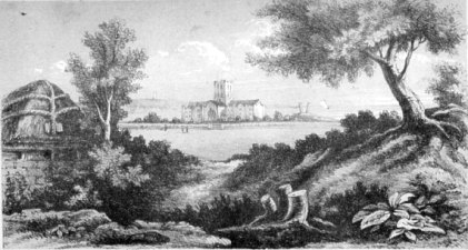
| View of King William's College from the Creggins, with Hango Hill, Castletown Bay and Langness
Round Tower in the distance |
for Frontispiece
|
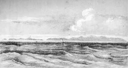
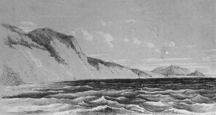
| Distant View of the Island |
4
|
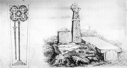
| Runic Cross and Old Font in the Churchyard of Braddan, and Stone Coffin-lid at Rushen Abbey |
20
|
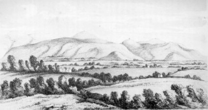
| The Creggins Hill from the Silverburn |
54
|
| Natural arch on Langness |
88
|
| Cosnahawin at the mouth of the Santon-burn |
108
|
| Castletown from the Stack of Scarlet, showing the contortion of the Limestone beds |
124
|
| Spanish Head from the Chasms |
150
|
| Peel Cathedral from Orry's Head |
196
|
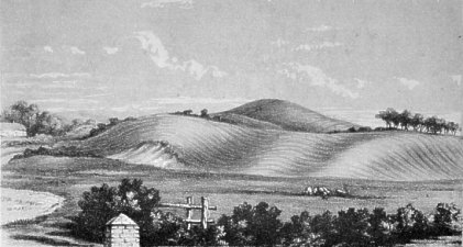
| Portion of the Mountain range between Sulby Glen and Bishop's Court, as seen from Andreas Churchyard |
222
|
|
|
King William's College from the Creggins
Creggan's Hill is about 1km northwest of the College - today's view would be across Ronaldsway Airport as the hill
is just across the road from the terminal
|
|
|
Distant View of the Isle of Man approached from the South East
|
|
|
Stone Coffin Lid Rushen Abbey
View in the Churchyard of Braddan
|
|
|
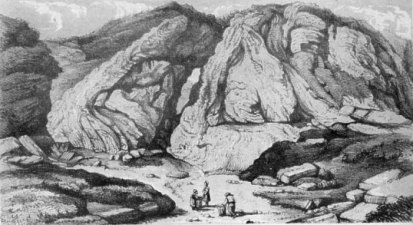
The Creggins Hill from the Silverburn
I think this might be looking south from near the one-time Cotton mill
(now Cumming's flax mill ?) though Cumming's description is I think from a point near today's Ronaldsway halt station
where there exists a small foot bridge across the Siverburn
As we pass down the Silverburn, a few hundred yards below the flax-mill,... for about 300 yards till we come to
a rustic wooden bridge, and then on the other side (the eastern side) take a seat upon the steps which carry the
footpath alongside of the first gate which stops up the bridle-road hence to the Creggins. It is an enchanting station
for the lover of scenery, and deeply interesting will it prove to the geologist...
The Creggins Hill in front is of an oblate hemispheroidal shape, and rises to the height of 130 feet above the
high-water sea-level. To the north of it is a lower hill of similar shape and character, and the major axis (so
to speak) of each of them runs nearly magnetic east and west,.... A flat terrace of gravel fringes round the base
of these hills at a bright of twenty-six feet above high-water mark. Yonder group of trees to the eastward, hard
by the high road and the Creggins farm-house, have fixed their roots deep into and luxuriated upon this pebbly platform.
But the steps on which we are seated are on the level of a still lower platform of fine alluvial sandy loam, upon
which the river in its meanderings has made great inroads, and deposited in its stead a considerable quantity of
montane detritus, boulders, gravel and sand. In the corner of the field on our right, on the opposite side of the
road from the cottage, is a patch of turfy ground, from underneath which, in a whitish marl, have been turned up
some remains of Cervus megaceros. The drift-gravel directly before us is worn into cavities, presenting all
the appearance of a low sea cliff exposed to the action of breakers.
|
|
|
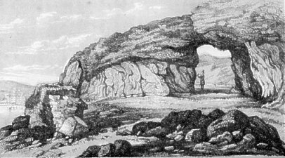
Natural Arch on the western side of Langness
The figure in the arch would appear to be a geologist!

|
|
|
Cosnahawin at the Mouth of the Silverburn
|
|
|
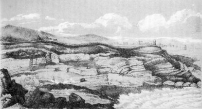
Castletown from the Stack of Scarlett
|
|
|
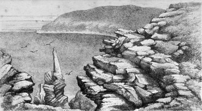
Spanish Head from the Chasms
Looking down onto the Sugarloaf
|
|
|
Peel Castle and Town from Orys Head
|
|
|
Mountain Range in the Isle of Man from Andreas
|
|
|
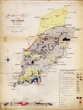
PLATE I.
1. General Map of the Isle of Man, coloured geologically, with a Table of Signs
and Colours. The outer dotted line represents the coast at low-water; the continuous coast-line is high-water-mark.
2. General Section across the south-western part of the Island from Lhergydhoo, north-east of Peel, across the granite
boss on South Barrule to Langness Point, south-east of Castletown.
|
|
|
PLATE II.
Geological Map of the Limestone Basin and other parts of the southern district of the Island, as it is supposed they
would appear if denuded of the gravels, sands and clays of the Tertiary period.
This Map exhibits the relations of the Carboniferous limestone to the Old Red sandstone formation and the great Schistose
series of the Island, and the intersection and contortion of this area by igneous rocks.
|
|
|
PLATE III.
In this Map we have included the Tertiary formations denuded in Plate II. The different shades of yellow and green
represent the Boulder-clay, the Drift-gravel and the newest Marine and Freshwater alluvium with raised beaches, and
exhibit the formation of long valleys of denudation during a period of elevation of the Island, and the manner in
which some portions of the Tertiary series have been preserved by the peculiar arrangement of the palaeozoic rocks.
|
|
|
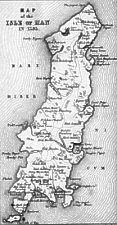
PLATE IV.
Map of the Isle of Man in 1595, performed by
Thomas Durham, as given in Camden's ' Britannia,' Speed's 'Chronicles,' Chaloner's History,' and Bleau's 'Atlas,'
published at Amsterdam. It exhibits ancient lakes both in the north and south of the Island, which arc now drained.
|
|
|
PLATE V.
1. Ground Plan of a portion of Poolvash Bay, as seen at low-water at the n.outh of the streamlet which flows from
Balladoole into the sea. It exhibits a remarkable series of Bosses on the surface of the limestone, caused apparently
by the intrusion of trap rocks, which are abundant in that neighbourhood.
2. Section North and South magnetic in the above Plan across the Bosses, snowing the undulations.
|
|
|
PLATE VI.
1. Ground Plan (coloured geologically) exhibiting the details of the Coast from Ronaldsway, near Derby Haven, to
Coshnahawin, at the mouth of the Santon-burn, and marking the position of the faults, cracks and axes of disturbance
connected with the elevation of the Brough, and the formation of a series of Bosses in connection with trap dykes
along the axes of disturbance.
Sections 1, 2, 3 and 4 to the above Plan, are intended to illustrate the elevation of the Brough at the mouth of
the Santon-burn, and the manner in which the Bosses may be supposed to have been formed by the intrusion of trap amongst
the pebbles of the old red conglomerate. The letters of reference, O P, A T, S R, Q K, shore the direction of the
lines of section.
|
|
|
PLATE VII.
Various Sections exhibiting the arrangement of the different formations in the South of the Island, the intersection
of the area by dykes of trap and porphyritic greenstone, and the consequent faults and undulations of the surface.
1. Section from Brada Head to Coshnahawin, showing the denudation of the older rocks after the formation of the great
faults and undulations, the deposit of the tertiary gravels, sands and boulder-clays on the abraded surface, and the
formation of alluvial basins by the action of the sea, during a still subsequent elevation of this area.
2 & 3. Sections from the Mull Hills to Langnes, and from Black Hill to Scarlet Head, illustrating the formation
of the stratified trap-tuff with the included Posidonian schist.
4. Ground Plan, showing the ramifications of trap when traversing beds of the Old Red conglomerate on the eastern
side of Castletown Bay. See page 84 of this work.
5. Section near the Stack of Scarlet, exhibiting the contortion of the limestone and the trap-tuff by a second volcanic
disturbance.
6. Section at the Calf of Man, showing the remarkable position of a mass of stratified gravel and sand at an elevation
of nearly 400 feet above the present sea-level. See page 155 of the present work.
|
|
|
PLATE VIII.
l. Section in the North of the Island from the mountain range near Ballaugh to Jurby Point, showing the formation
of the great Curragh and the freshwater marl basins, in which have been found the remains of the great Irish Elk.
N.B. The arrangement of the limestone and Old Red conglomerate is theoretical, as detailed in the body of the work,
page 210.
2. Section through Hango Hill and King William's College to the Creggins, exhibiting the Cliff of Boulder Clay and
the arrangement of the drift-gravel and alluvium.
3. Section at the mouth of Glen Willan, near Kirk Michael, showing a valley of denudation in the drift-gravel and
boulder clay, with terraces of alluvium at different levels.
|